Happy Fall! We’re thrilled to share our recent product launches, including additional weather data fields, upgrades to the platform, and new vertical-specific offerings.
Real-Time Weather Monitoring for All Moving Assets
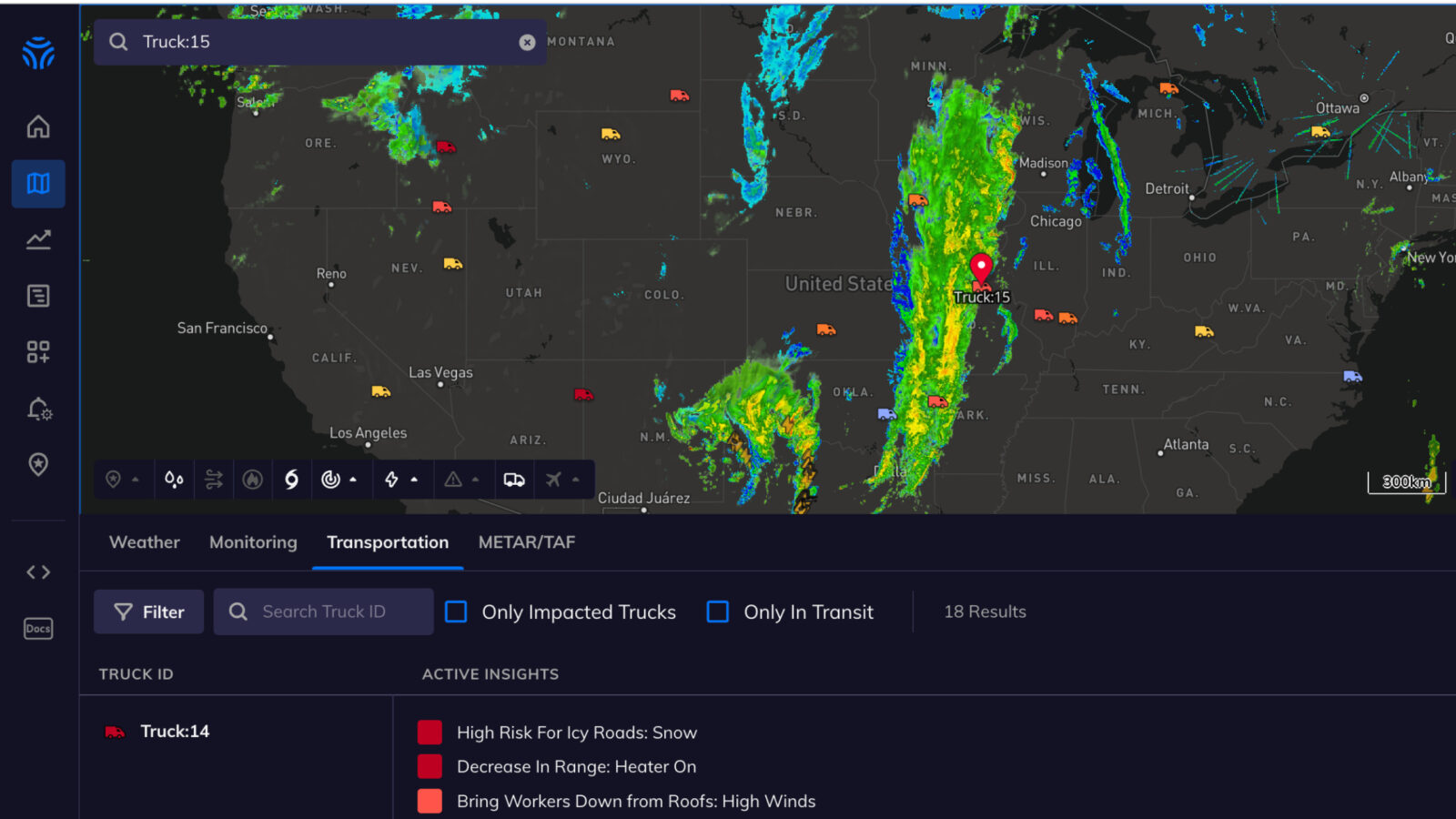
We’re very excited to announce the release of a game-changing feature for the transportation industry: Real-Time Weather Monitoring for all moving road assets. Customers can automatically monitor and identify which vehicles face hazardous conditions in real time to ensure driver safety and minimize accidents across their full network of moving assets.
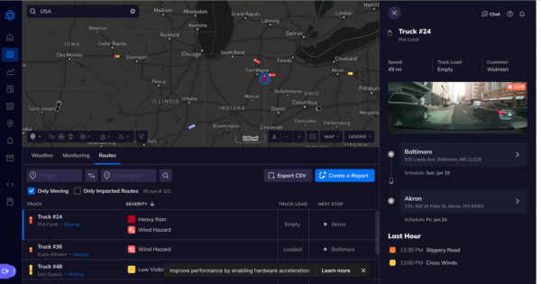
Seen on the Tomorrow.io Map, Real-Time Monitoring allows you to automatically identify which vehicles face dangerous conditions and confidently contact drivers at the right time to prevent accidents.
By connecting the Tomorrow.io Platform with a telematics API (and dashcam feed), users can monitor drivers’ hyperlocal weather, apply insights/alerts, and combine with real-time driver, truck and load information to access automated lists of drivers in need of urgent communication.
This geo-based weather monitoring is a game changer for the trucking industry, providing complete situational awareness for all weather events including those with sudden changes in intensity and incidents that are sudden, extreme and short-lived.
Learn more here, and watch an overview here. Please contact your account team to learn more about adding this premium offering to your account.
Lightning Alerts in the Platform
We’ve also released lightning alerts in the platform for both cloud-to-cloud and cloud-to-ground lightning strikes.
Previously only available outside of the platform, users can now understand when and where lightning strikes pose a threat with automated proximity-based alerts and all-clear timers that let you know when it’s safe to resume operations. Lightning alerts can be supplemented with precipitation insights and severe weather advisories for robust monitoring.
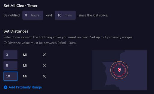
Through the alerts page, users will also be able to add or edit an alert with configurable fields like lightning type, designated locations (only available for point locations, not polygons or polylines) and proximity ranges. Users can also customize all-clear thresholds and designate alert recipients here.
Please contact your account team if you have any questions or to receive access to this premium feature.
High-Resolution (1-km) CONUS Flood Index
We’ve launched a new high-resolution CONUS Flood Index, a first-of-its-kind scalable rapid-refresh hydrologic prediction model and data product for rapid response and emergency management available via API, Maps, and the Insights Dashboard.
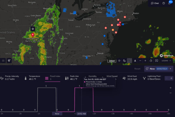
Like the previously released Flood Index, the high-resolution CONUS Flood Index indicates the risk of flooding on a scale of 1-5, from minor flash flooding possible to extreme or catastrophic river or flash flooding probable or likely. The index is based on our proprietary model with decades of data points processed from runoff, streamflow, ponded water, and forecast data.
This high-resolution CONUS Flood Index significantly enhances our flood prediction capabilities with a 1 km-resolution forecast out to 18 hours and updated hourly (then blended with the 9 km-resolution Flood Index out to 5 days).
Note that this product is available to customers who have purchased the FLOODS add-on. Please reach out to your account team with any questions or to receive access to the Floods premium DPL.
METAR/TAF-Based Insights and Alerts
In addition to building alerts on METAR (real-time airport observed data), aviation customers are now also able to create insights with TAF data (next-day official airport forecast data), including visibility, cloud base, cloud cover, wind speed, direction, etc.
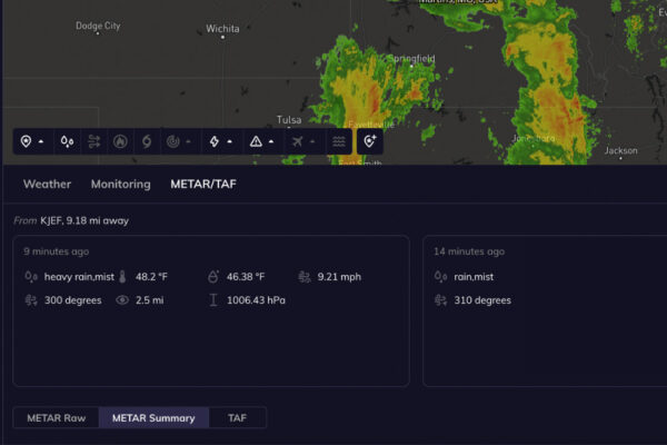
METAR and TAF Data are available in the timeline API. METAR and TAF-based insights and alerts can also be created and customized accordingly to better support existing procedures across airports.
Please contact your account team if you have any questions or to learn more.
Dashboard Rapid Refresh:
To enhance platform user experiences, we’re happy to announce a significant enhancement to our dashboard refresh rate. With the change, users are able to attach locations to insights in a dashboard and see changes applied and calculated in just ten seconds!
Want to See These Features for Yourself? Try Tomorrow.io Today
