Unlock the Power of NextGen Weather Data
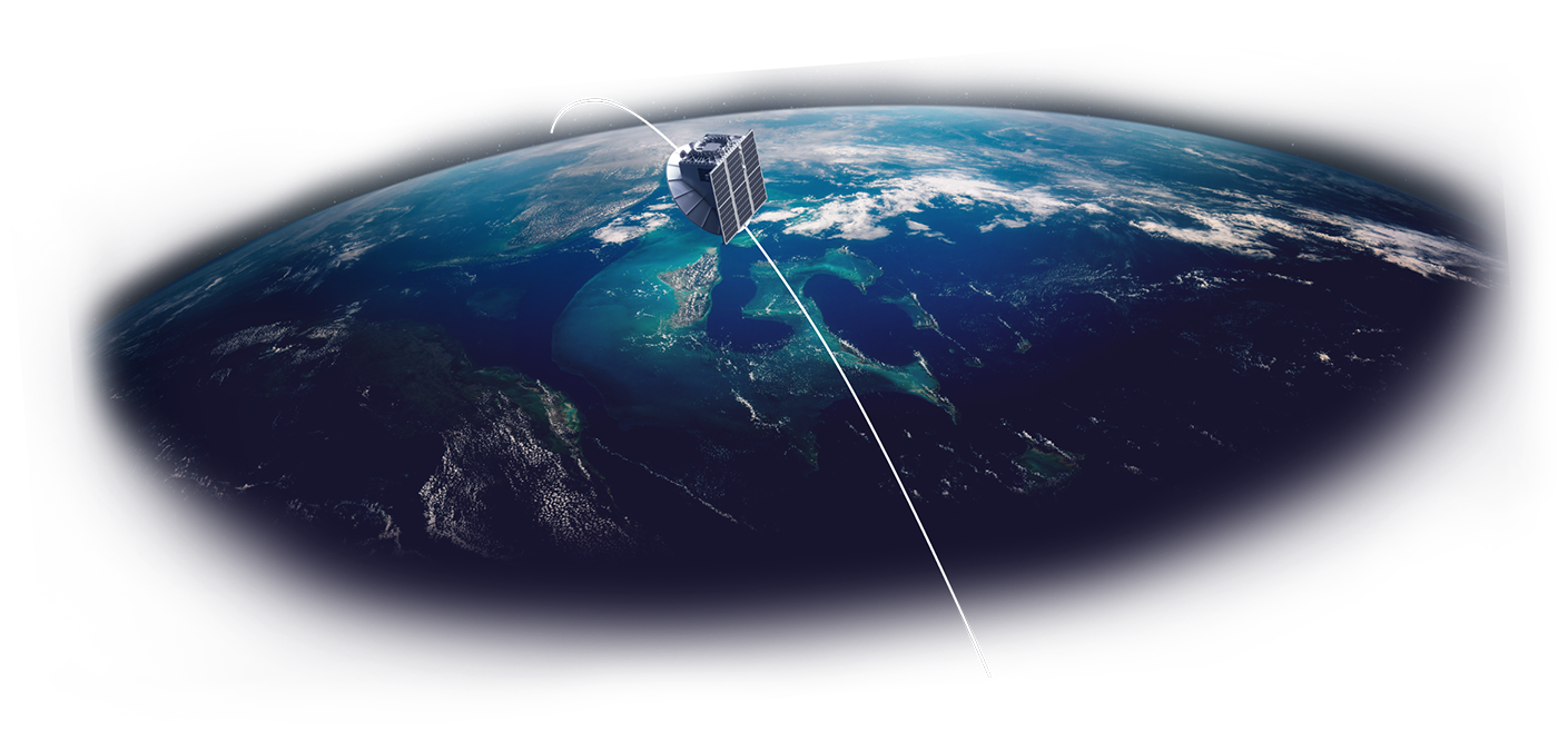
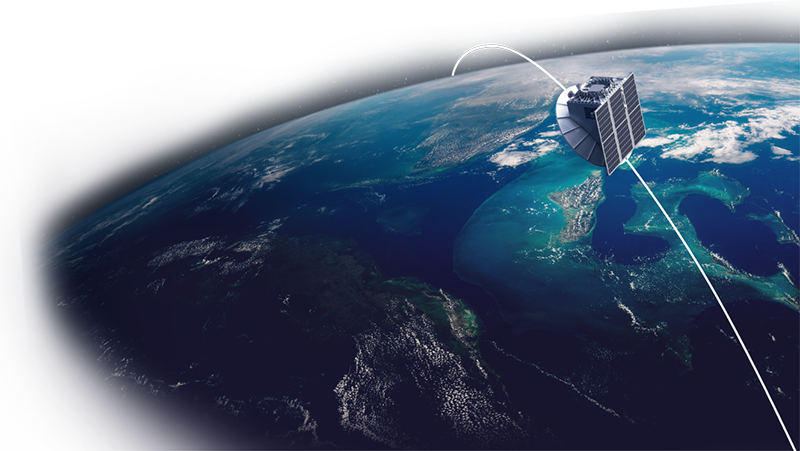
Predict, prepare, and adapt to weather and climate impact like never before with advanced, rapid-refresh data. Captured from Tomorrow.io’s first-of-its-kind weather radar satellite constellation, our groundbreaking approach paves the way for organizations around the globe to access previously unreachable critical weather insights.
Choose the Right Data Product
Our satellite data provides rapid-refresh products ranging from antenna temperatures to advanced retrievals via flexible processing for customized datasets. Choose from:
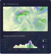
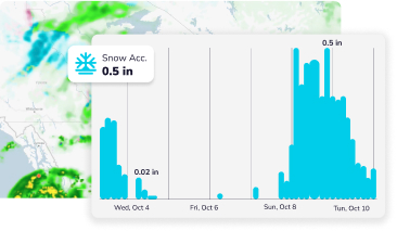
Radar Data
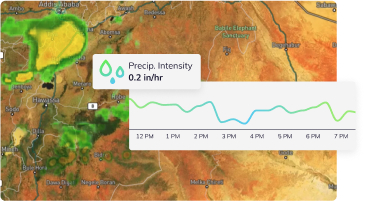
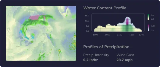
Reflectivity and precipitation profiles updated frequently
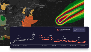
Passive Microwave Data
Global brightness temperature scans for temperature, humidity, and rainfall analysis
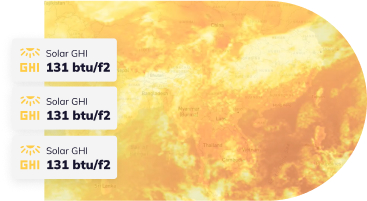
Integrated Products
Enhanced forecasting from combined radar and radiometer data
Transform Your Operations with Precise Insights
From agriculture to aviation, our data powers smarter decisions across all industries by providing advanced visibility into upcoming weather events. Integrate our products to reduce disruptions, mitigate threats, and increase efficiency.
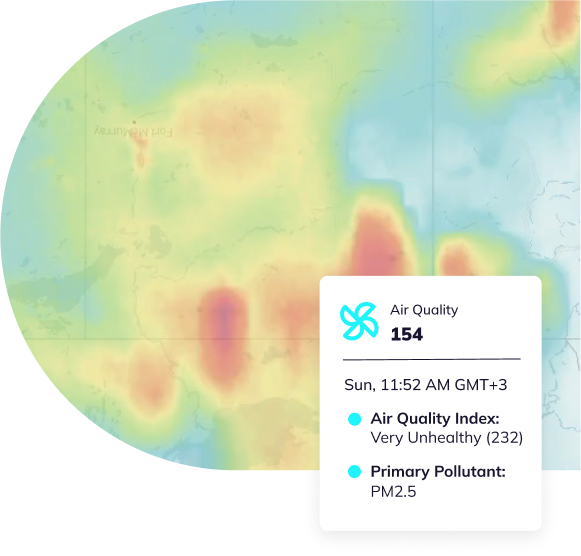
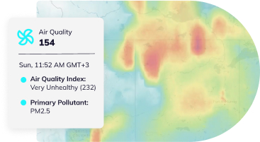
Government
Our satellite data provides national, regional, and local government bodies worldwide, as well as public institutions, with advanced weather data to better serve citizens. Integrating our real-time tracking and forecasting enables improvements in:
Public Health Protection
Public Health Protection: Proactively allocate medical resources and personnel ahead of hazardous weather events.
Infrastructure Optimization
Disaster Management
Enterprise
Our precise weather data powers smarter business decisions across sectors by providing enhanced visibility into weather conditions. Companies can leverage our satellite measurements to optimize:
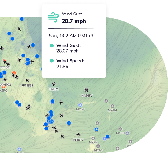
Aviation
Reduce flight delays, improve safety, and identify severe weather earlier with accurate forecasts.
Energy
Agriculture
Government
Our satellite data provides national, regional, and local government bodies worldwide, as well as public institutions, with advanced weather data to better serve citizens. Integrating our real-time tracking and forecasting enables improvements in:
Public Health Protection
Public Health Protection: Proactively allocate medical resources and personnel ahead of hazardous weather events.
Infrastructure Optimization
Infrastructure Optimization: Identify at-risk infrastructure, prioritize repairs, and optimize maintenance based on the most up-to-date weather impact projections.
Disaster Management
Disaster Management: Improve early warning systems, better allocate resources, and enhance preparedness with real-time tracking of extreme weather.
Enterprise
Our precise weather data powers smarter business decisions across sectors by providing enhanced visibility into weather conditions. Companies can leverage our satellite measurements to optimize:
Aviation
Reduce flight delays, improve safety, and identify severe weather earlier with accurate forecasts.
Energy
Pinpoint ideal crop planning based on forecast insights, optimize water usage, and manage pest and disease risks.
Agriculture
Pinpoint ideal crop planning based on forecast insights, optimize water usage, and manage pest and disease risks.