As 2023 comes to a close, we want to thank you for your trust and support of Tomorrow.io over the past year.
It’s been an amazing, whirlwind of a year at Tomorrow.io — we launched the world’s first two commercially-built radar-equipped satellites, updated our weather API to be the most robust available, and have partnered with companies like Microsoft to drive our innovations forward.
All the while, our mission has never been more critical, with NOAA reporting that the number of billion-dollar weather events we’re seeing is increasing every year. In 2023, the U.S. alone has seen 25 confirmed weather/climate disaster events with losses exceeding $1 billion each. From droughts and floods to cyclones and severe storms, these events have resulted in nearly 500 deaths and immense economic impact.
With your support, we’ve led the way in bringing scalable, actionable solutions to advance climate adaptation and resilience for every person, business, and government on the planet.
Along the way, we’ve released exciting product updates and features designed to transform how organizations respond to weather.
Keep reading to learn about key product updates we made in 2023 and how they’re designed to help you in the new year and beyond.
Highlights
NextGen
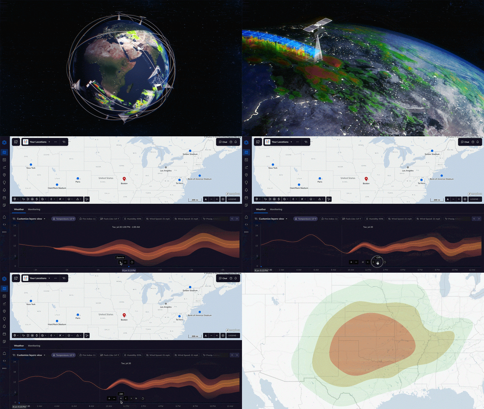
This year, we announced the upcoming release of NextGen—our most advanced weather intelligence yet. 🚀
With significantly more accurate hyperlocal models, revolutionary probabilistic forecasting, and advanced thunderstorm analytics, NextGen will unlock new capabilities to optimize decisions amid weather uncertainty.
Tomorrow.io Satellite Data
This year, we launched the world’s first commercially built weather-radar satellites. We are proud to share that samples of our first-of-its-kind data directly from our pathfinder satellites are now available.
Gale
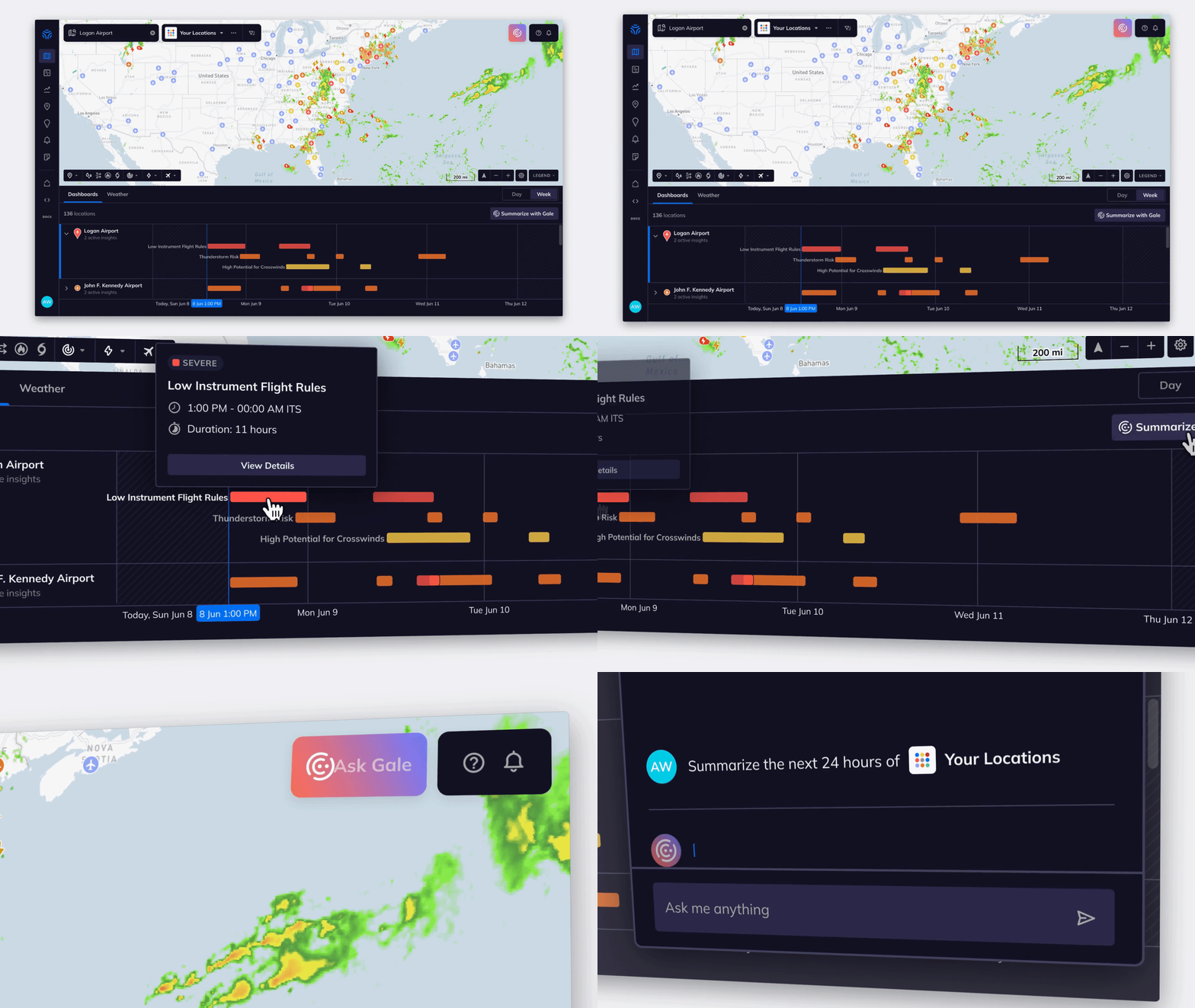
Tomorrow.io is leading the way in weather AI. In March of this year, we announced the industry’s first weather and climate generative AI, nicknamed Gale. Gale is a premium feature in the Tomorrow.io weather intelligence and climate adaptation platform.
Email Digests
This year we launched our email digest! With Tomorrow.io you can generate a one-time, daily, or weekly weather report to share with your teams forecasting weather 12 to 4.5 days out.
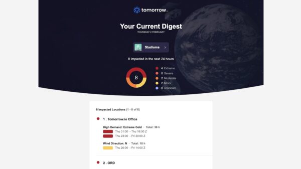
Tomorrow.io’s Email Digest
Our email digests include pie chart summaries of weather-impacted locations by severity levels so users can quickly understand which locations require action.
Enhanced Forecasting & Modeling
Snow Depth Layer
With Tomorrow.io, you can view the depth of snow on the ground in the U.S.! This update provides you with real-time and forecast snow depth data up to two days out.
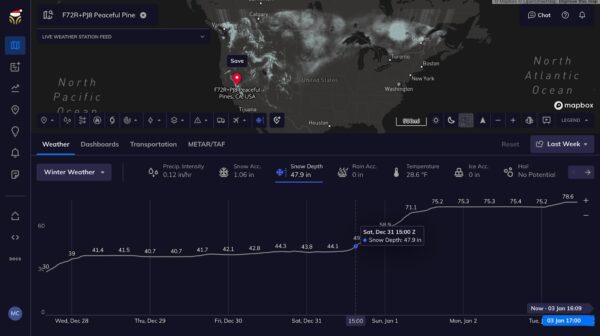
Tomorrow.io’s Snow Depth Layer
Unified Precipitation v2.0
In March we released our new Unified Precipitation(UP) solution, which provides more accurate precipitation data from 0-6 hours for high-impact weather events, thanks to a cutting-edge approach supercharged with machine learning and AI.

Low Level Winds & Temperatures – U.S. and Israel
You can now access low-level wind and temperature data for 11 altitude ranges from 10 to 300 meters for the U.S. and Israel.
Users can visualize historic, real-time, and forecast conditions at different heights via the altitude slider. This is particularly useful for the aviation, construction, energy, and drone operators industries.
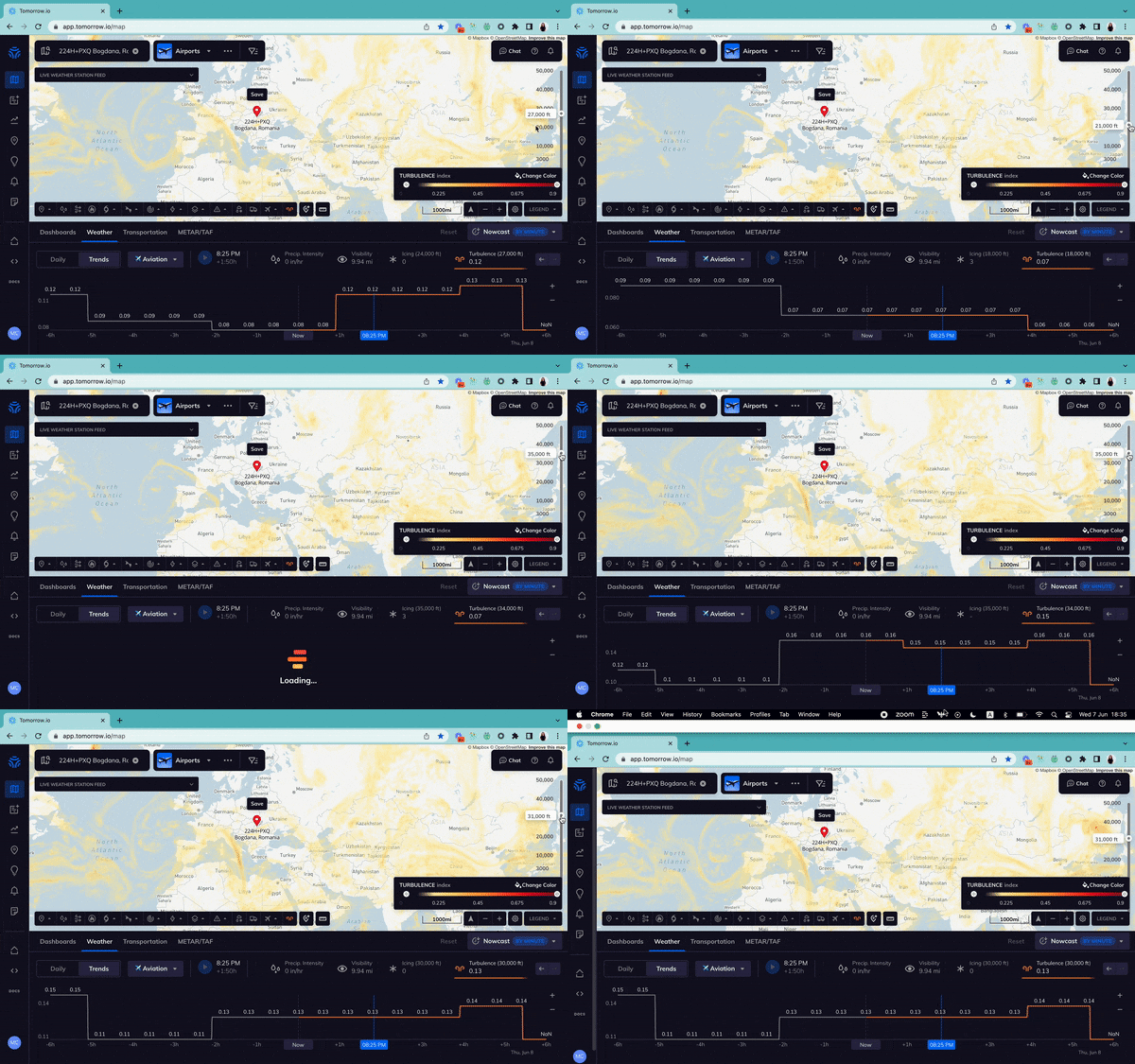
Flight Level Weather Data
Tomorrow.io now offers flight-level observations from 3,000 to 55,000 feet globally. This includes wind, temperature, icing risk, and turbulence data to aid aviation and drone operators. Users will be able to access historical and forecast weather data for the parameters that matter most to them.
Map & Data Visualization
In-Map Ruler
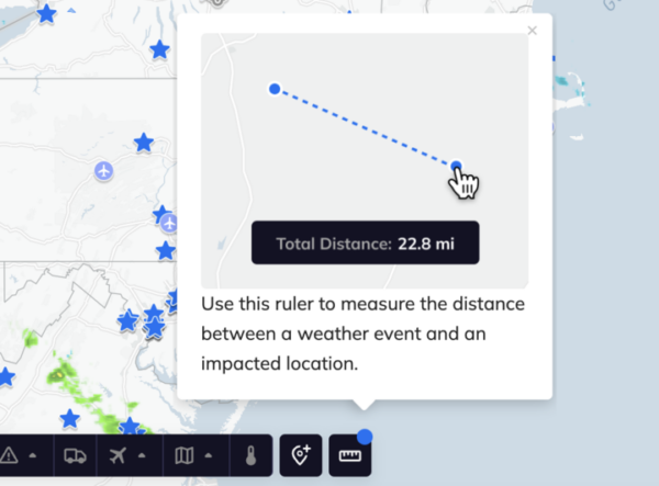
A new measuring tool in the Tomorrow.io platform allows users to measure the exact distance of an active weather event-impacted location.
Heatmap Customization
Tomorrow.io has made vast improvements to their map visualization. The following map upgrades improve interactivity and customization:
- Customizable color palettes
- Filterable heat map ranges
- Unified settings tab
- Hoverable temperature

Enhanced Wind Mapping
Tomorrow.io has upgraded its wind speed and direction data layers (DPLs) to provide more visual clarity into wind conditions.
The wind speed DPL shows velocities via color-coding on the map timeline. Wind direction is displayed with wind barbs instead of colored heat maps.
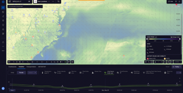
Wind Speed DPL
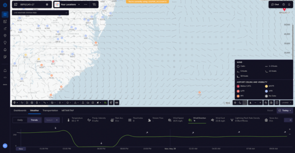
Wind Direction DPL
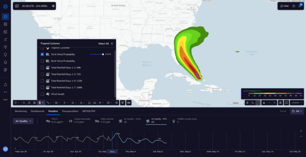
Tropical Cyclones Layers
Before this enhancement, tropical cyclones were shown on a data single layer over Tomorrow.io’s maps.
Now there are separate layers for:
- Forecast track cone of uncertainty
- Watches and warnings
- Observed track
- 5-day wind swath
- Wind speed probabilities
Alerting & Notifications
Lightning Notifications Update
Experience improved lightning alerts at Tomorrow.io, now available in two new convenient locations on our platform, in addition to emails and SMS:
Notification List: Effortlessly track and review chronological alerts for seamless monitoring.
Alerts log: View a list of lightning alerts in chronological order.
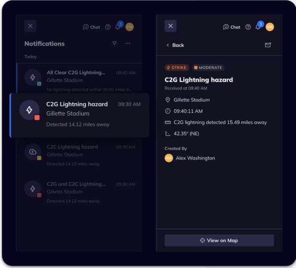
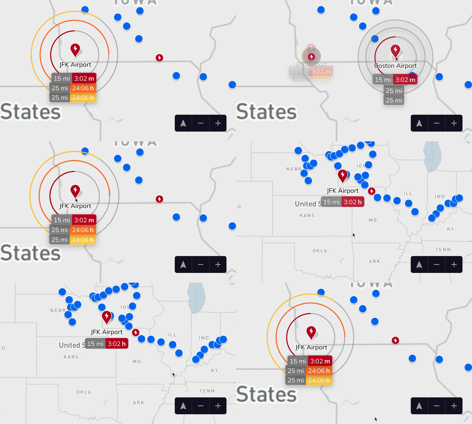
Lightning Alert Improvements
With upgraded lightning features, you can track lightning from any map zoom level. Icons show affected locations, with bolding to highlight active strikes.
Countdown rings help assess distance of threats.
Streamlined Alerts
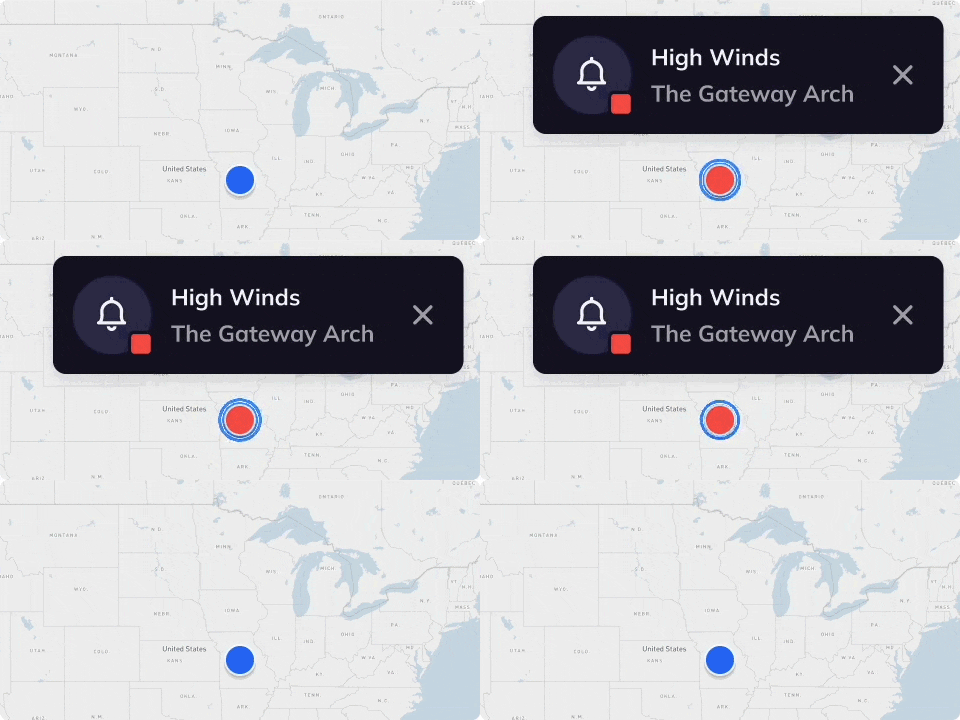
Bulk Edits and In-App Notifications
The Tomorrow.io team is thrilled to share a Bulk Alert Editing enhancement to boost efficiency in managing alert recipients, locations, and status.
New in-app notifications also raise awareness of triggered alerts.
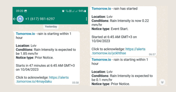
WhatsApp Integration
Great news for WhatsApp users!
Tomorrow.io’s platform alerts now integrate with WhatsApp to bring your team seamless notifications directly to WhatsApp accounts.
Current customers now have the option to add on this premium feature and receive weather insights and alerts via WhatsApp.
Users will be able to select their account to receive alerts only via WhatsApp, SMS, or both.
Here’s how new notifications will appear through the WhatsApp application.
Analytics
Polygon/Polyline Insights
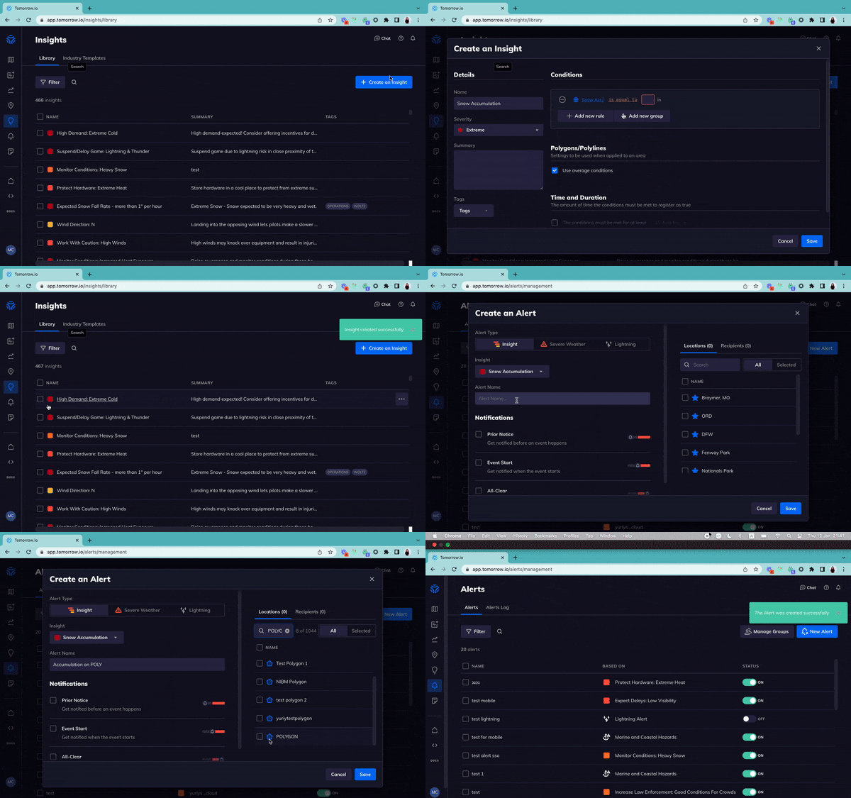
You can now use polygon and polyline average values to generate insights conditions enabling you to attach accumulation insights to polyline/polygons if the average checkbox is used.
Historical Timeline
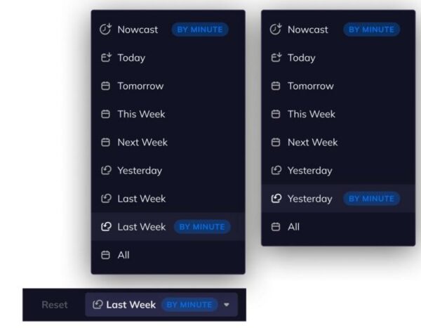
With the release of Tomorrow.io’s historical timeline, we now provide minute-by-minute weather data for the past 24 hours and previous 7 days.
Other Feature Upgrades
Aviation Updates
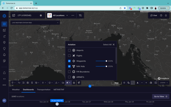
We made a lot of progress on updates for the aviation industry this year. With the Tomorrow.io platform, you can now access waypoints and Nav aids all over the world.
Global Waypoints & NAV Aids
We have upgraded our aviation Waypoints and Nav Aids data layers to expand beyond the US to global coverage
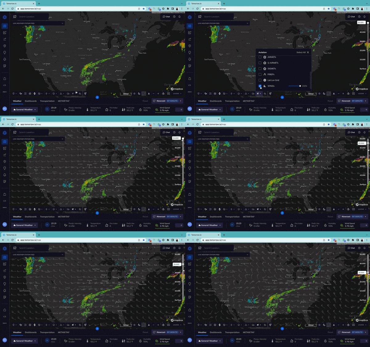
Wind Barbs at Altitude
Users can now see wind barbs at altitude.
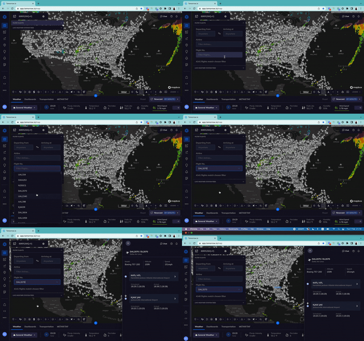
Search Flights By Flight Number
Users can now search flights by flight number.
Historical Climate Normals
Early this year we made an update to our historical weather data offering with the launch of Tomorrow.io’s Historical Climate Normals API endpoint.
Climate Normals is a comprehensive view of climate patterns over 20-year period. This endpoint enables you with weather data that uses hourly temporal resolution to calculate and present data from 2000-2020.
Conclusion
That’s a wrap on 2023! With the upcoming expansion of our first-of-its-kind satellite constellation, 2024 is going to be a banner year and we can’t wait to share it with you along the way!
Wishing you a happy holiday season and a healthy start to the new year!

