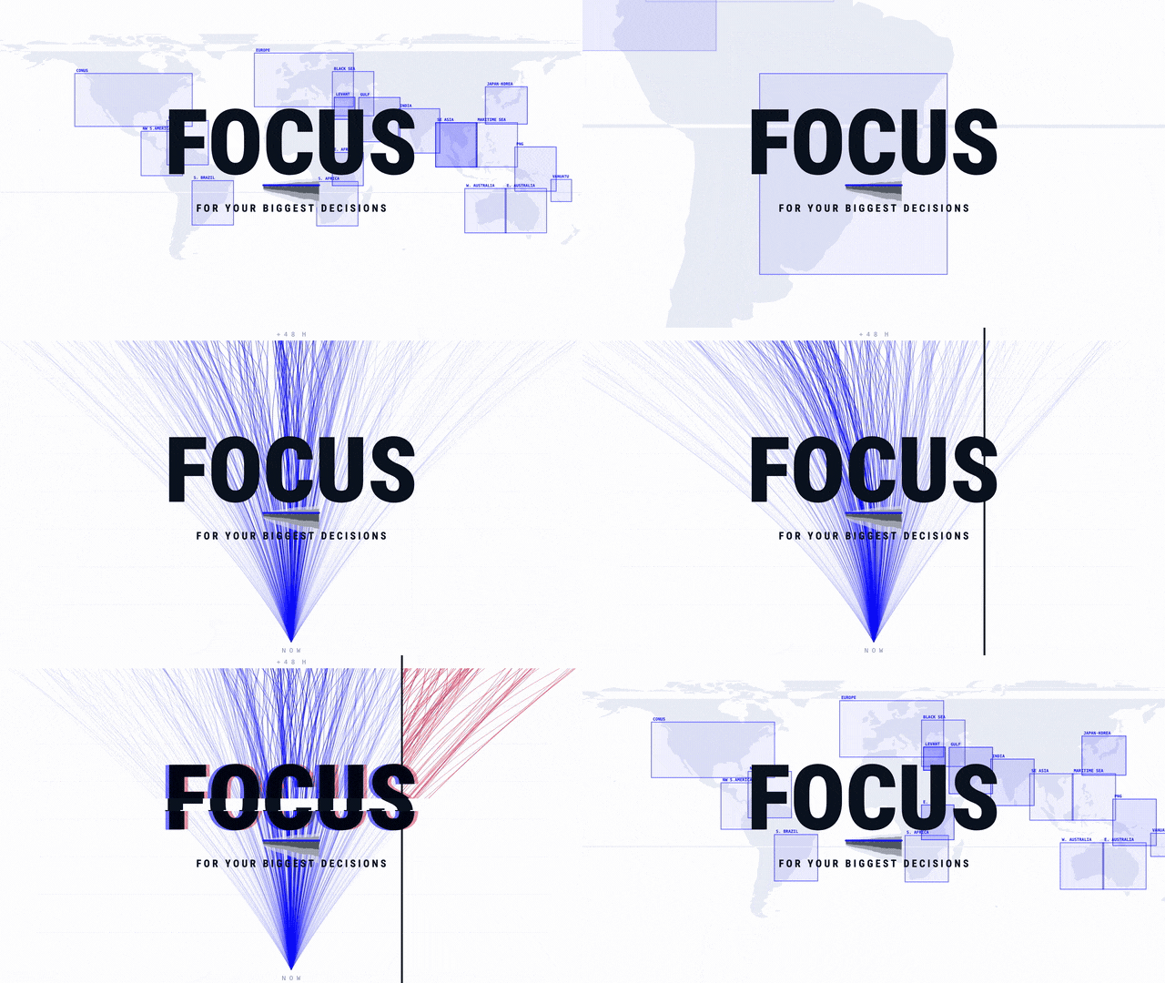
Sky 1 rebuilds the starting picture every hour. From the launch film.
Every forecast begins the same way. Physics or AI, every center on Earth, no exceptions: the sky gets frozen into a single still 4D frame. One instant, everywhere at once — surface to stratosphere, temperature and wind and moisture and pressure, resolved onto a grid that wraps the planet.
That frame is the model’s entire knowledge of the present. Everything the forecast will ever say unfolds from it.
Meteorology calls it the initial conditions. The starting picture.

The picture doesn’t exist. It has to be built.
And here is the part that surprises almost everyone outside the field: the starting picture is not a frame that already exists waiting to be frozen. It must be built.
No instrument measures the atmosphere.
Instruments measure pieces of it. A satellite reads down through a column of air from orbit. A balloon samples one thread of sky above one airfield, twice a day. An aircraft records the air it happens to fly through, along the routes airlines happen to fly. Millions of readings arrive every day from thousands of sources — different instruments, different moments, different assumptions, disagreeing with each other at the edges.
None of them is the sky. And all of them together still aren’t the sky: they’re a patchwork of measurements with enormous holes between them, over oceans, over deserts, over most of the Southern Hemisphere.

Something has to turn that scatter into one coherent world.
That something is called data assimilation — a piece of infrastructure most people have never heard of, and that every forecast on Earth depends on. It takes what we know about how the atmosphere behaves, everything that was just observed, and all the emptiness in between, and resolves them into a single defensible answer to a question that sounds much simpler than it is:
What is the sky doing right now?
Get that answer right and a good model has a chance. Get it wrong and every hour that follows is wrong from the first second — not because the model failed, but because it was aimed at a sky that had already moved.
Which means the question that decides a forecast was never really how good the model is.
The picture today is old. About four times a day old.
Most of the world’s operational global models rebuild their starting picture on a six-hour cycle. Four editions a day — roughly midnight, six, noon, and six again, by the clock in Greenwich.
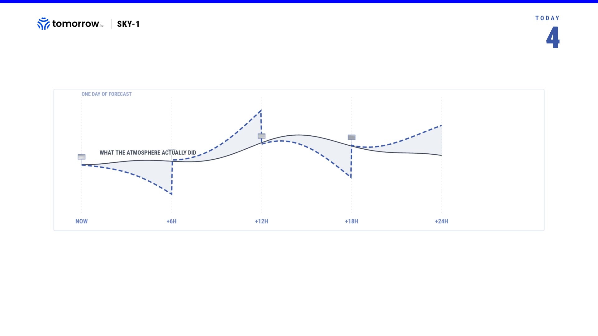
That cadence isn’t arbitrary, and it isn’t inertia. Assembling a global starting picture was for decades among the most expensive computations anyone performed routinely: gather millions of observations, weigh each one against a physical model of the atmosphere, and solve for the single most consistent state of the entire planet.
And you have to wait — readings arrive late, from ships and aircraft and satellites moving on their own orbits, and the cutoff has to fall somewhere. Six hours was a sound answer to both problems at once. Four editions a day was the correct engineering for an era when printing was expensive.
Some regional systems already do better. The United States rebuilds an hourly picture over its own territory, and it works well. But it covers a fraction of the planet, and weather doesn’t stay inside it.
The sky never agreed to the schedule.
Picture the atmosphere as a roll of film running without pause, every hour of it exposed. A forecast doesn’t get the roll. It gets four frames, and builds the twenty hours in between out of inference.
A thunderstorm is born, matures, and dies in thirty to sixty minutes. Its whole life fits inside one gap, several times over. A tropical cyclone can gain a category between two frames. The model isn’t wrong about those hours. It was simply never shown them.
And here is the part worth sitting with: the gaps aren’t empty. They’re filled — with the model’s own best guess about what happened next.
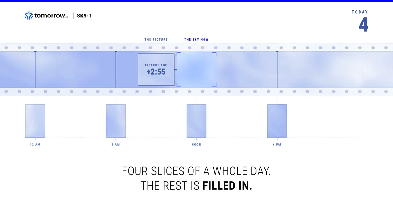
Between observations, the atmosphere’s official state is a short forecast carried forward from the previous state, held until a new reading arrives to correct it. That isn’t a flaw; it’s how assimilation is designed to work. But it means a great deal of what a forecast “knows” about right now is not a fresh instrument reading. It’s an estimate, several steps removed from anything a sensor actually saw. A copy of a copy, until an observation re-enters and resets the chain.
Most people assume the reverse — that current conditions are the measured part and the forecast is the guess. In the hours between frames, both are guesses. One is just younger.
None of this is accidental. It’s the best available answer to a genuinely hard problem, built by the national centers whose work is the reason forecasting functions at all. Every model on Earth starts from that picture. Ours included.
To repeat: understanding what’s happening right now carries a great deal of the same guesswork as predicting what happens next.
Which raises a question the field has mostly not asked out loud. Not how do we forecast better — that one has been answered, repeatedly and with brilliant progress, for a decade now.
But: who is working on the picture itself?
The layer nobody rebuilt
The last decade of progress in weather went almost entirely into one layer.
And it worked. AI models now forecast the global atmosphere with skill that rivals the physics-based systems it took fifty years to build, and they do it in minutes instead of hours, on hardware that fits in a single computer server. It’s one of the real scientific achievements of the decade, and it arrived fast enough that most people outside the field haven’t caught up to it yet.
But look at what all of them have in common.
Every one of those models begins by being handed a starting picture built by someone else. They are good at the question given this state of the atmosphere, what happens next? None of them answers the question what is the state of the atmosphere? They receive it — from the national centers, on the six-hour clock — and they inherit whatever it contains.
It’s worth drawing the stack out, because once you see it, you can’t unsee where the effort went.
Nearly all of the last decade’s investment, talent and attention went into the third box. The fourth is finally getting attention. The second was treated as plumbing — necessary, unglamorous, and above all free, because the national centers have produced it for decades and handed it to everyone at no charge.
That was a rational thing to assume. It’s also the assumption that quietly set the ceiling.
Because the starting picture was designed for a particular customer. It was built to initialize physics solvers running four times a day on supercomputers, and it is superb at that. But times are changing, and the world in which only a handful of institutions run models like these is changing with them.
It was not built for a generation of models that can produce a global forecast in the time it takes to make coffee — models that could run every hour, if there were anything new to run on.
The engines were rebuilt. The fuel still arrives four times a day.
Research on this is real and serious — the national centers and several labs are actively working on learned assimilation, and they should be. But the picture nearly every operational forecast on Earth starts from today is still the six-hourly one.
That’s the bottleneck now. Not the model. The map it starts from.
Five problems wearing one name
So why hasn’t it simply been rebuilt?
Because improving the starting picture isn’t one problem. It’s five, and each is hard in a different direction.
Five problems, one layer. None of them are glamorous. All of them upstream of everything anyone ever sees.
Which is exactly why it stayed plumbing for so long. And exactly why we went after it.
Introducing Sky 1
We built Sky 1 to work on that layer.
It isn’t a forecast model. It doesn’t compete with the world’s best predictions — it decides what they start from.
The mechanism, plainly: Sky 1 takes the atmosphere’s current best estimate — the picture the national centers built, on their clock — and adds the observations that have arrived since it was made. Then it resolves the two, what we believed against what we’ve just seen, into a corrected picture of the present. Anything that runs afterwards inherits it.
The centers redraw their picture four times a day.
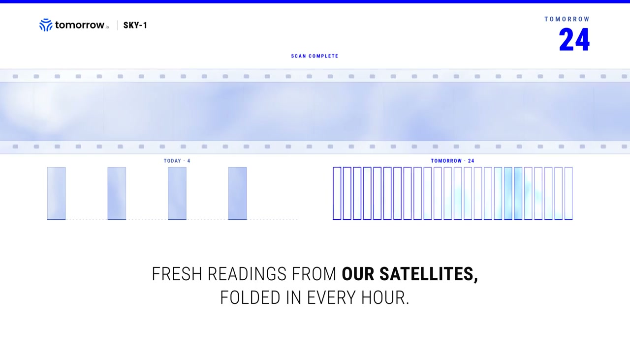
Sky 1 redraws it twenty-four times a day.
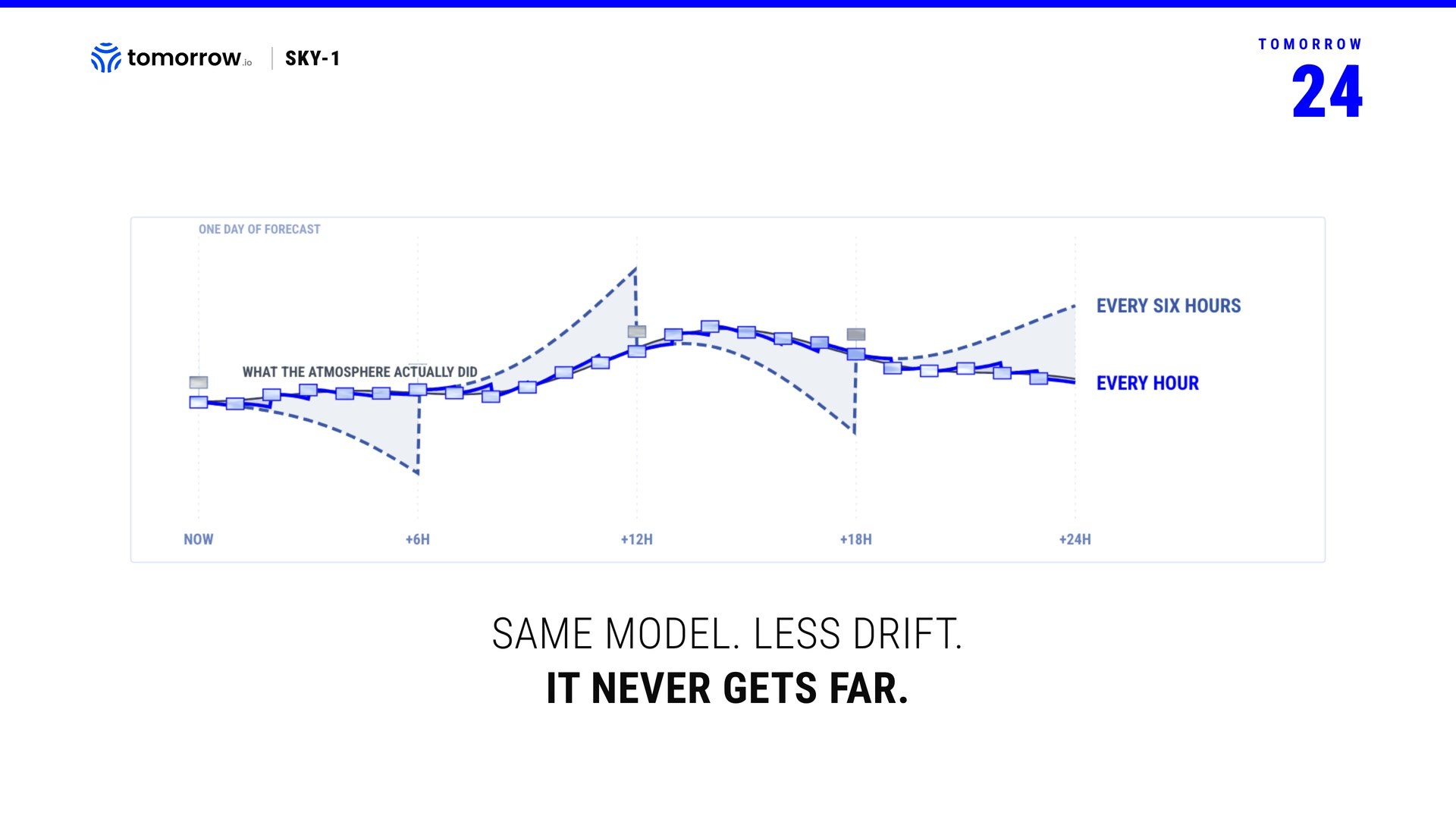
To be exact about what that means: the underlying estimate is still theirs. We start where everyone starts. What refreshes every hour is what the picture knows from the newest looks. That’s the whole claim, and it’s enough — because the gap between frames is where storms are born, and it’s the part nobody was filling.
Hourly became possible because the expensive step stopped being expensive. For decades, resolving belief against observation meant an enormous optimization: solving for the most consistent state of a planet, one cycle at a time, on the largest machines available. An AI model approaches it differently. It doesn’t solve the problem from scratch on every cycle — it has already learned what the answer tends to look like. That change in method is what turns a six-hour computation into something you can run on the hour.
The observations come from our own instruments: the Gen-1 fleet, eleven active microwave sounders in orbit.
A sounder doesn’t photograph the top of a storm. It reads down through the column — how warm, how wet, at what altitude — through clouds, over open ocean, across the stretches of the world where the conventional network thins to almost nothing. It measures the vertical structure of the atmosphere, which is precisely what a starting picture is made of, and precisely what’s hardest to observe from anywhere else.
And because the instruments are ours, we know things about them that nobody consuming a public feed can know. Which one is drifting? Which channel has aged? How much to trust a reading taken at a shallow angle over ice against one taken straight down over ocean. Deciding who to believe was the first of the five problems — and owning the instrument is a structural advantage in solving it. It’s also the kind of advantage that doesn’t commoditize when the data does.
There’s one more thing that changes when you look often enough.
One pass tells you where a storm is. Two passes, close together, tell you how fast it’s growing.
It travels with the data
The upgrade travels with the data, not the model.
Because Sky 1 works on the starting picture rather than on the forecast, what it produces isn’t bound to any one model. Almost anything built to begin from initial conditions can begin from fresher ones.
That isn’t a claim about compatibility. It’s a consequence of where the layer sits. A better map doesn’t care which vehicle is reading it.
We’ve demonstrated it with one model so far — an openly published foundation model for the atmosphere, the kind anyone can download and run. We’re working with their team on the right metrics this new world has to show. Same model, same weights, no retraining. The only thing that changed is what it starts from: a picture built with what our sounders read an hour ago, instead of the public cutoff from hours ago. Same engine. A fresher present.
This is also, deliberately, not a competitive posture.
The frame isn’t ours, and we’re not trying to take it. The world’s forecasting centers built the picture everyone starts from — including us. Sky 1 begins from their work and adds what has happened since. That’s the entire relationship, and we’d rather state it plainly than imply something grander.
There’s a strategic logic to standing here, and it’s worth being honest about. New forecasting models keep arriving — from research labs, from technology companies, from national centers — and they will keep arriving. The concept of a forecast model has fundamentally changed.
Building the layer underneath all of them isn’t a bet at all — it’s an innovation meant to propel every one of them. Good infrastructure has that shape. It doesn’t compete with what’s built on top of it. It raises the floor under all of it, whether those models are our stack or someone else’s.
What we’re not claiming
Sky 1 does not forecast. It produces initial conditions. If a downstream model is wrong about the next five days, a fresher starting picture will not save it.
A fresher present is not yet a measured improvement. What a fresher picture is worth — track error, lead time, the numbers a forecaster would actually check — is the subject of a methods paper, and ours is being written. Until it lands, this piece carries no improvement figure.
Hourly is our cadence, not a universal fix. Observations also go unused because dense data carries correlated error — a statistical problem, not a latency one. Sky 1 does not address that, and we don’t claim it does.
Fewer gaps between the snapshots
We opened with a strange fact: to predict the atmosphere, you first have to stop it.
That will always be true in some form. A model needs a state to begin from, and a state is a single instant.
But there’s a difference between stopping the sky four times a day and stopping it every hour, and the difference isn’t only arithmetic. At four frames, the present is something you reconstruct between glimpses. At twenty-four, it starts to behave like something continuous — a picture that is always being corrected rather than periodically rebuilt. Less a series of photographs. More a feed.
That’s the direction this goes. Not a better snapshot. Fewer gaps between the snapshots, until the gaps stop deciding what a forecast can know.
Which is what makes this the argument for building more of the sky.
An instrument added to a world that can’t use it well is worth roughly what it measures. An instrument added to a layer that knows how to weigh it, place it, and fold it into the present within the hour is worth considerably more — and it keeps being worth more as the layer improves around it. Looking compounds only if something is there to catch what you see.
With DeepSky we’re building more instruments. But Sky 1’s value doesn’t wait on any of that. It already turns what eleven sounders see today into a fresher present, every hour. Every instrument added after this makes the picture fresher still — and every improvement to the layer makes every instrument already in orbit worth more than it was.
The forecast has been the story for fifty years, and it deserved to be. It’s one of the quiet triumphs of applied science.
But every forecast anyone has ever trusted began with a guess about right now.
That’s the part we’re working on.
If you run decisions off a forecast and want to see what an hour-old present changes in the ones that matter, talk to us.
Sources
- ECMWF. Integrated Forecasting System documentation and forecast user guide — global 4D-Var assimilation on a six-hourly cycle (00/06/12/18 UTC) with observation cutoff times.
- NOAA/NCEP. Global Forecast System — four analysis and forecast cycles per day at 00, 06, 12 and 18 UTC.
- ECMWF. Observations used in the assimilation system — hundreds of millions of observations received daily from satellite, aircraft, radiosonde, ship and surface networks; a screened subset is assimilated each cycle.
- NOAA/GSL. High-Resolution Rapid Refresh (HRRR) — an hourly-updating, 3 km convection-allowing model with hourly data assimilation over the contiguous United States, operational at NCEP since 2014. (Dowell et al., Weather and Forecasting, 2022 — “The High-Resolution Rapid Refresh (HRRR): An Hourly Updating Convection-Allowing Forecast Model.”)
- NOAA/NSSL & NWS JetStream. Thunderstorm life cycle — single-cell (“ordinary”) thunderstorms last roughly 30 to 60 minutes through their developing, mature and dissipating stages.
- NOAA/NHC. Rapid intensification — defined as an increase of at least 30 knots in maximum sustained winds within 24 hours; documented extreme cases have exceeded a Saffir-Simpson category within a single six-hour window.
- Lam, R. et al. (2023). “Learning skillful medium-range global weather forecasting,” Science — a global 10-day forecast produced in under a minute on a single machine, with skill competitive against the operational deterministic system.
- Bi, K. et al. (2023). “Accurate medium-range global weather forecasting with 3D neural networks,” Nature — AI global forecast skill comparable to operational numerical weather prediction.
- Data assimilation background state. Standard practice across operational centers: between analysis times the atmosphere’s estimated state is a short-range forecast (the “background” or “first guess”) carried forward from the previous analysis until new observations correct it.
- Tomorrow.io. Gen-1 constellation — eleven active microwave sounders, current operational count. Sky 1 hourly restart cadence and mechanism; first-party system description. Methods paper in preparation.