
Weather is the most measured phenomenon on Earth, and for most of the planet the measurements were never taken. Over the oceans, across the tropics, throughout the un-radared world, the atmosphere goes hours unobserved — and those are the places where a late warning costs the most. DeepSky is the early warning constellation Tomorrow.io is building to close that gap: five instruments on one spacecraft, chosen so that each one sees what the others cannot.
The record that was never kept
Every forecast is downstream of a measurement somebody decided to take. A model learns from its training data; the data comes from an instrument; and the instrument exists because at some point a person decided that thing was worth measuring. For most of this planet, nobody ever made that decision.
Roughly 71 percent of the Earth’s surface is ocean, and essentially none of it is covered by ground-based weather radar. Across much of Africa, South America and Asia there is little or none either. More than five billion people live outside radar coverage entirely. Over much of the world, on most days, nobody can say with confidence whether it rained yesterday.
That is not a gap in the models. It is a gap in the record the models are built from — and a model cannot learn a sky that was never written down.
Warning is the whole argument
The gap is not evenly distributed, and neither is its cost. A storm that forms over open ocean is watched far less closely than one approaching a wealthy coastline. The events that most need to be seen coming are concentrated in exactly the places that are observed least.
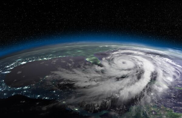
A hurricane deepens over water before anyone can measure how fast. A fire front moves further between satellite passes than the last picture suggested. A flood arrives in a valley where nobody measured the rain that fed it. A heat wave settles over a city without enough warning to open cooling centres. Surge and waves decide whether a coastline evacuates — and the wind driving them sits inside rain that most instruments cannot see through.
The people with the least warning are the people with the most to lose. It is not a modeling problem. It is a gap in what humanity chose to measure. — Shimon Elkabetz, CEO and co-founder, Tomorrow.io
Five ways to read one sky
You cannot read the atmosphere in one wavelength. Different physics live in different parts of the spectrum, so the DeepSky suite is built to read across it — visible light, infrared, microwave and radio. Each band answers a question the others cannot.
Gen-2 hyperspectral microwave sounders read temperature and moisture at many heights, straight through most cloud, day and night. This is the backbone of the starting picture: the observation class that carries the most weight in a global forecast, and the one that matters most over ocean and the un-radared world, where a forecast goes stale first. Because a sounder reads the whole column at once, where in that column a reading belongs is the thing it has to infer.
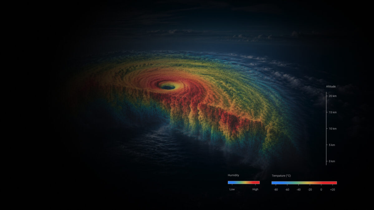
GNSS radio occultation is the reference the rest of the fleet is trued against. A navigation signal grazing the edge of the atmosphere bends as it crosses, and the bend is the measurement — timed against an atomic clock rather than a calibration table. It is unaffected by cloud and needs no radiometric calibration of its own, which is what makes it usable as a standard rather than as one more satellite’s opinion.
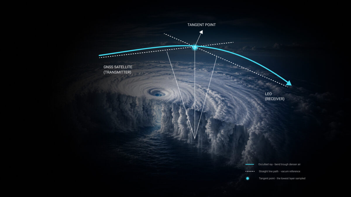
GNSS reflectometry reads surface wind inside a storm’s rain-wrapped core — the one place scatterometers and imagers go blind. Heavy rain scrambles a scatterometer’s return exactly where the dangerous winds live; imagers see the lid of cloud and nothing under it. Reflectometry reaches the winds that decide what a hurricane does to a coastline.
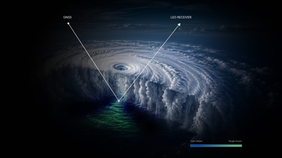
Infrared and visible imaging reads cloud, surface and thermal state on every pass over a scene. It is also how thermal signatures are found and followed, which gives the constellation the ability to identify and monitor fire conditions — the same physics that maps a cloud top locates a fire front.
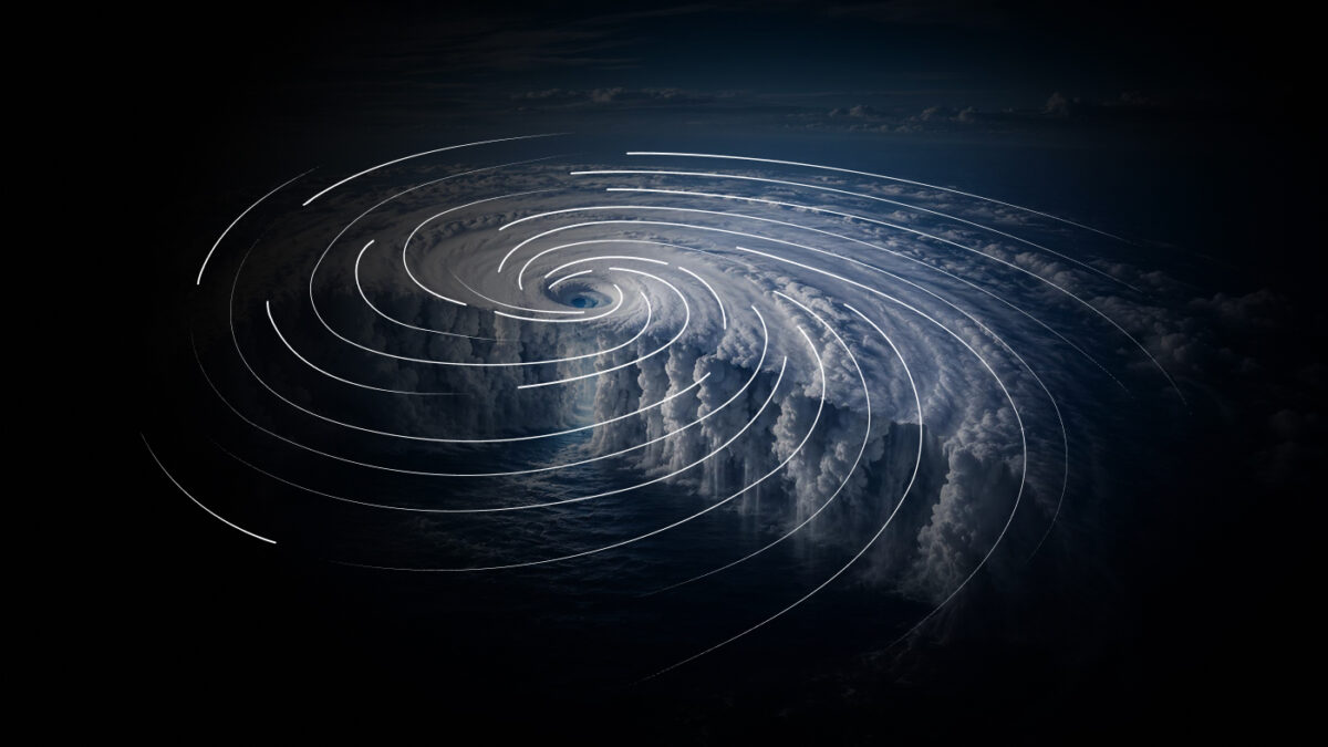
Precipitation radar from space is active where the others are passive. It sends its own pulse and reads what returns, giving precipitation profiles at high resolution. Where a sounder reads how much water a column holds, the radar reads where in the column it sits, where it melts, and how tall the updraft built. That is the difference between a total and an anatomy.
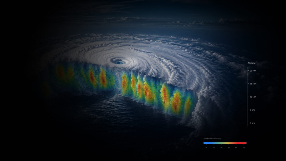
They don’t only cover each other. They calibrate each other.
Flying several sensors together is table stakes; every serious observing system does it. The argument for this particular five is that each one’s blind spot is another one’s ordinary work.
A hyperspectral microwave sounder’s radiances need a bias correction — a running model of the instrument’s own drift — before a forecast can safely use them, and that correction has to come from somewhere. Radio occultation supplies it, anchored to GPS timing rather than to another spacecraft’s calibration. The radar resolves the vertical structure a passive sounder can only infer. The imager adds the cloud and thermal picture the sounders do not carry. And the reflectometer reads the one condition that blinds the rest.
This could be circular — each instrument confirming the others’ mistakes. It isn’t, because the web is pinned to things that do not drift: occultation is timed against an atomic clock, and radiosondes and ocean buoys are direct physical measurements taken independently of any satellite. Anchored there, cross-referencing sharpens the picture instead of echoing it.
None of these capabilities is hypothetical. Each is the heritage physics of its modality, established in orbit by the missions that flew it first.
These are other people’s instruments, in other people’s missions, published by them. They are cited here for the one thing they establish — what each modality can do — and not as results belonging to DeepSky.
A large spacecraft, flown in numbers
The DeepSky spacecraft is being built substantially larger than the microwave sounders flying today — and considerably larger than the cubesat-class platforms most people picture when they hear “smallsat constellation.” The size is not decorative. It is what a five-instrument suite requires.
Higher power runs the active sensors. A radar has to transmit real energy to see inside a storm rather than on top of it, and that energy has to come from somewhere — solar area, batteries and thermal capacity all scale with the bus.
More onboard processing and downlink shortens the trip from a look to a usable observation. A faster picture is only worth what arrives in time to use it.
And all five instruments have to fly on the same spacecraft, at the same time. That is what the size actually buys. Co-located instruments read the same column of atmosphere in the same moment, which is what makes the interlock real rather than notional — this is one observatory, not five separate missions whose data gets reconciled afterwards.
Then there is the second half, and it is independent of the first: DeepSky is a proliferated low-Earth-orbit constellation. Many of these spacecraft, in low orbit. Refresh and coverage are a function of how many of them there are.
Large and numerous is not a contradiction. The size is what lets one spacecraft carry the whole suite; the number is what turns that suite into continuous coverage. And past a certain refresh rate the measurement itself changes — you stop recording only where the weather is and start measuring how fast it is changing. A camera becomes a speedometer, and a storm is caught while it is intensifying, which is the difference between a warning and a report.
Who this is for
Tomorrow.io does not issue national met warnings. National meteorological and hydrological services do, and they carry the legal responsibility for warning entire populations — often tens of millions of people — across terrain where there are almost no observations to work from. Civil protection agencies, water authorities and agriculture ministries all sit downstream of them. DeepSky is built to make that job easier.
It is built as well for everyone whose work weather disrupts: global aviation, agriculture, insurance, energy and supply chains. Most industries have quietly adapted to a thin picture. Airlines carry extra fuel. Growers spray on a wider window than they need. Insurers price uncertainty into the premium. Shippers build slack into schedules. Utilities pre-stage crews for storms that may not arrive. None of that is waste exactly — it is the cost of deciding without enough information, paid every day, by everyone. A better observation record does not only sharpen a forecast. It shrinks the buffer and improves the understanding of risk.
A forecast can only be as good as what was actually measured. Across most of the planet nobody ever built the instruments to do the measuring. — Rei Goffer, Chief Strategy Officer and co-founder, Tomorrow.io
What flies today, and what is being built
The distinction matters enough to state plainly. DeepSky is being built. It does not describe what is in orbit this morning.
The capability behind DeepSky is not theoretical either. Tomorrow.io’s radar pathfinders demonstrated precipitation radar from a small satellite, and captured a tropical cyclone’s interior from space — proving in orbit the measurement DeepSky is designed to fly at scale.
A continuous sky
The field has never been short of models. The open models released over the last few years are a genuine gift to it — the frame isn’t ours, and we’re not trying to take it. But when models become abundant, what becomes scarce is whatever reality the model has not seen. And the largest such reality is the sky nobody wrote down: the ocean, the tropics, the un-radared world, and the hours when something was intensifying and nothing was watching closely.
Every model is downstream of its data. Every dataset is downstream of an instrument. And every instrument is downstream of somebody deciding what was worth measuring.
That decision is what a constellation is. Five instruments, chosen so that each covers what the others cannot, writing down a sky that was never written down before — not a reconstruction of it, a record of it. The world does not need fewer warnings. It needs earlier ones.
Sources & attribution
- Ocean share of Earth’s surface. Standard geographic constant (~71%). Almost none of it is covered by ground-based weather radar.
- “More than five billion people live outside radar coverage.” Tomorrow.io first-party estimate, derived from national radar-network coverage against population. A first-party figure, not a third-party measurement.
- Commercial radio occultation in hurricane forecasts. Addition of commercial RO profiles on top of COSMIC-2 reduced minimum-central-pressure error by roughly 10–15% at 24 to 36 hours across four Atlantic storms (2022), in a national hurricane-forecast model. That mission’s data in that centre’s model, published by them — not a DeepSky result.
- Said et al. (2021), CYGNSS Ocean Surface Wind Validation in the Tropics, J. Atmos. Oceanic Technol. Wind RMSD below 2 m/s under 20 m/s against moored buoys. A NASA CYGNSS result, credited to that mission.
- Spaceborne precipitation radar heritage. TRMM (1997) through GPM (2014) — roughly three decades of continuous precipitation radar in orbit. Attributed to those missions; no DeepSky performance is implied.
- Gen-1 fleet — eleven active microwave sounders. Current operational count in orbit. DeepSky is the next-generation constellation now being built and is nowhere described here as current coverage.
- Radar pathfinders. Tomorrow.io demonstrated precipitation radar from a small satellite (2023) and captured a tropical cyclone’s interior from space (2024). Stated in the past tense as demonstrated capability.
- No DeepSky-specific figure appears in this article — no power, latency, revisit, band, resolution, channel set or fleet count. None is public and none has flown. Refresh, power and scan depth are described as directions, not numbers.
- No comparative performance claim is made against any forecasting centre, mission or open model. Every model and mission named belongs to its makers.