Establishing Credibility for Satellite Weather Data in Real-World Storms
When severe weather is unfolding, the most critical question isn’t how fast you can detect it. It’s whether the data you’re relying on actually reflects reality.
Before evaluating speed, coverage, or operational readiness, satellite weather data must pass the most fundamental test: Is it accurate under real, chaotic conditions?
That’s the question NOAA set out to answer during Typhoon Ragasa, and the answer laid the foundation for everything that comes next.
The Challenge of Measuring Inside a Typhoon
Typhoons present some of the harshest environments for atmospheric observation.
With dense cloud layers, intense rainfall, and rapidly evolving temperature and moisture gradients, these storms make it nearly impossible for many satellite sensors to maintain accuracy. Traditional optical sensors often lose visibility when it’s needed most, right inside the storm.
To overcome this, NOAA relies on ground-truth benchmarks like radiosondes. These high-altitude weather balloons measure temperature, humidity, and pressure directly as they ascend through the storm. Radiosondes offer a gold standard for comparison because they aren’t inferred or modeled; they measure the actual state of the atmosphere.
Matching these benchmarks inside a live typhoon sets the highest bar for satellite data.
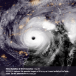
Real Storm, Real Test: NOAA’s Validation During Typhoon Ragasa
In September 2025, during the peak of Typhoon Ragasa, NOAA tested Tomorrow.io’s space-based microwave sounder data against nearby radiosonde observations. These comparisons were not simulations. They were direct validation efforts during an active tropical cyclone, with measurements taken within a few hours and kilometers of one another.
Here’s what NOAA found:
- Temperature and water vapor profiles from Tomorrow.io’s satellite closely aligned with radiosonde measurements
- Rain rate and total precipitable water (TPW) matched trusted reference products used by NOAA
- Performance held even under extreme conditions inside the typhoon
These results confirmed that Tomorrow.io’s data accurately captured real atmospheric dynamics even inside a storm where other systems often struggle or fail.
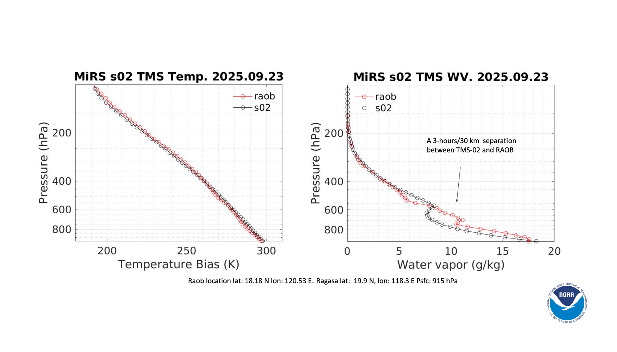
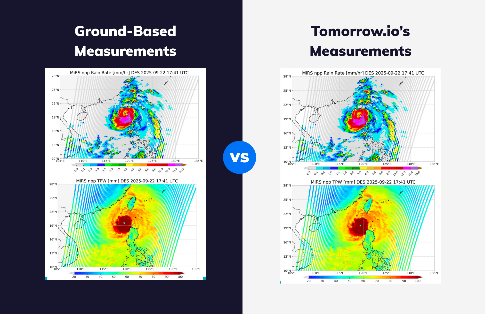
NOAA compared Tomorrow.io’s satellite measurements with a radiosonde launched near Typhoon Ragasa. The profiles show a close match in temperature and moisture, confirming the data’s accuracy during an active storm.
This was not just good performance. It was a validation of physical accuracy under the most difficult conditions possible.
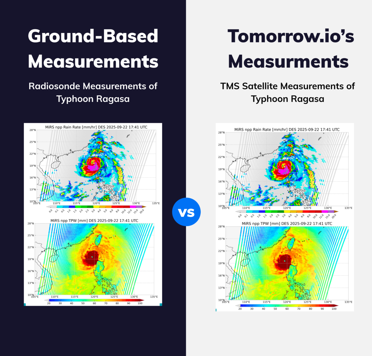
Microwave retrievals from Tomorrow.io revealed rain rate and total precipitable water inside Typhoon Ragasa, even through dense clouds. These visualizations demonstrate the advantage of microwave sensing in storm conditions.
Why Microwave Observations Are Built for Extreme Weather
Microwave sensors operate on different physics than traditional optical instruments. Instead of relying on visible or infrared light, which clouds can block, microwave instruments can see through clouds and precipitation. This makes them uniquely suited for storm observation.
This is especially critical for tropical cyclones, where visibility is limited and rapid changes can define the storm’s evolution.
Typhoon Ragasa proved that Tomorrow.io’s microwave sounder is not just theoretically better in storms. It works when it matters most.
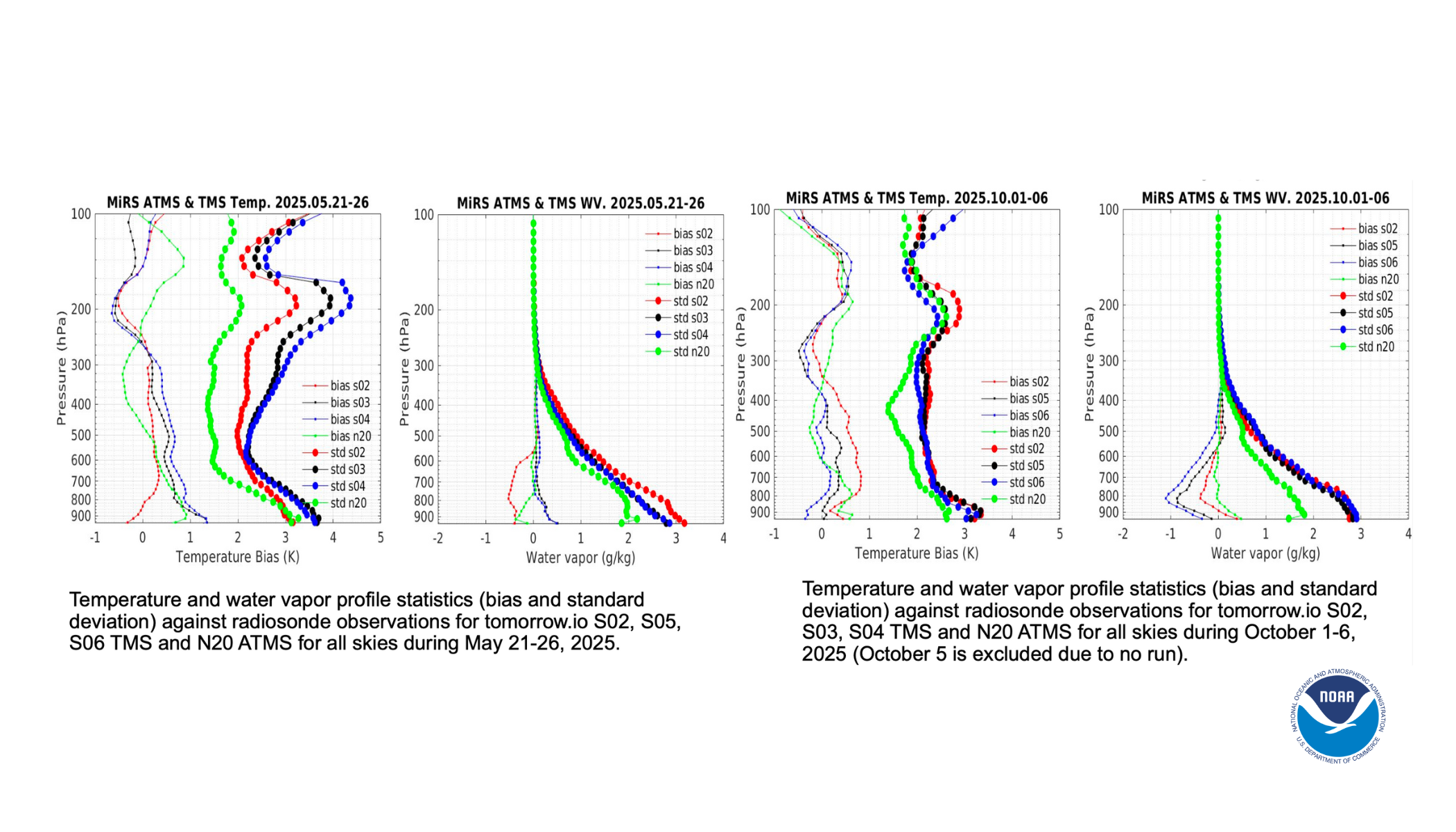
Bias and standard deviation statistics from NOAA show that Tomorrow.io’s temperature and moisture profiles aligned with radiosonde observations across multiple satellites. This consistency strengthens confidence in the data’s reliability.
This all-weather capability gave NOAA temperature, moisture, and rainfall insights that stood up to the toughest ground-truth comparisons available.
This Validation Is the Foundation for All Future Use
NOAA’s test was not about proving speed, constellation design, or operational workflows. It was about something more basic and more important: proving that the data is real.
Before NOAA could evaluate how often the system observes storms or how well it integrates into forecast workflows, it needed confirmation that the data reflected actual atmospheric conditions. Typhoon Ragasa provided that confirmation.
This matters because every downstream benefit, from faster update rates to operational decision-making, depends on credible data. Without that foundation, nothing else in the system holds weight .
What It Means Moving Forward
With this validation, Tomorrow.io’s satellite data has met NOAA’s most demanding standard. It works under real-world, high-impact conditions.
This data is not modeled, estimated, or inferred. It is measuring the physical reality of the atmosphere, and doing so in the exact places and times forecasters need it most.
In future posts, we will build on this foundation to explore:
- How system-level design gives Tomorrow.io an architectural advantage
- Why reliability at scale matters just as much as individual success stories
- And how operational forecasters are already using this data in real decision-making environments
But everything starts here. With data you can trust when it matters most.