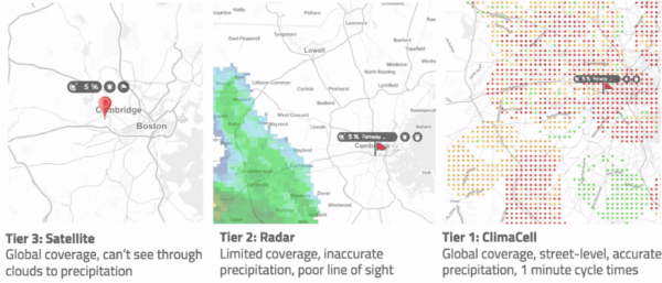
Weather radar is the most valuable remote sensing tool for detecting precipitation and related high-impact weather events (i.e., thunderstorms, flash floods, blizzards, and hurricanes). At Tomorrow.io, we’ve pioneered unique software-defined radar (SDR) via our proprietary ARENA technologies, and our SDR-powered Pathfinder satellites have been collecting data from space since mid-2023 to better detect and forecast these high-impact events.
Now, through in-depth comparative evaluation, we’re announcing breakthrough results: By leveraging Artificial Intelligence (AI) and neural networks in the processing, we’ve demonstrated that these Ka-band Smallsat radars can achieve comparable accuracy with the state of the science, ground-based radar networks.
Synopsis
- Impressive quantitative results comparing Tomorrow-R1 and Tomorrow-R2 against MRMS, the United States ground radar system (Nexrad) data product, almost perfectly correlated.
- Better results than the Ka Product of NASA’s GPM. Demonstrates that a constellation of Ka-band radars can provide highly accurate precipitation estimates in all weather conditions.
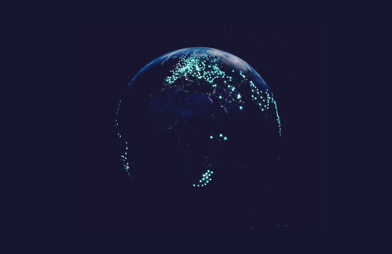
- At scale, Tomorrow.io’s constellation will provide global data that will unlock AI models’ ability to operate with sufficient initial conditions.
Validating Game-Changing Measurement Capabilities
In April and June 2023, Tomorrow.io launched our first two Pathfinder satellites hosting ARENA – Tomorrow-R1 and Tomorrow-R2 – SDR radars finely tuned to observe key environmental variables like precipitation. Built on an entirely new architecture using pulse compression and frequency agility, ARENA provides flexibility to adapt beamforming, signal processing, and operating modes via software updates uploaded regularly from the ground.
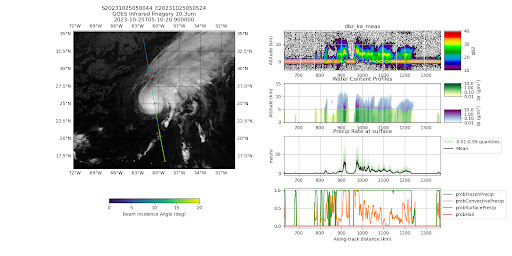
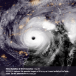
Tomorrow-R2 data captured over Hurricane Tammy on October 25, 2023. The just-in-time tasking capability of the Pathfinder was demonstrated by explicitly targeting the instrument to scan the storm’s eye, showcasing the flexibility of the mission operations to capture data in extreme weather conditions.
The radar data is first processed to the fundamental measurement unit of radar reflectivity, which measures the power scattered back to the radar by particles in the atmosphere and the earth’s surface. While this data can provide useful information directly about the structure of clouds and precipitation, further processing is required to convert it to atmospheric variables such as liquid water content, ice water content, and precipitation rate.
Tomorrow.io’s unique algorithm uses Machine Learning (ML) to leverage the vast amount of data collected by NASA’s Global Precipitation Measurement (GPM) mission satellite, which also carries a Ka-band radar like the Tomorrow.io Pathfinders but has an additional frequency at Ku band which provides further information about rainfall intensities. The algorithm is trained with these dual-frequency-derived precipitation profiles but only uses the Ka-band observations as input. Nevertheless, the complex relationship between the reflectivity profile shape and precipitation is “learned” by the algorithm, and the full precipitation profile is retrieved even in cases where the Ka-band reflectivity is completely attenuated by heavy precipitation. The ML algorithm also provides the probability that a profile has precipitation reaching the surface, convective precipitation, falling snow at the surface, and hail.
Validation of Performance
To verify the accuracy of the Pathfinder precipitation product, we compared the output over a comprehensive 5-month period from August to December 2023 against NOAA’s Multi-Radar Multi-Sensor (MRMS) precipitation data in several statistical categories covering detection and intensity accuracy.
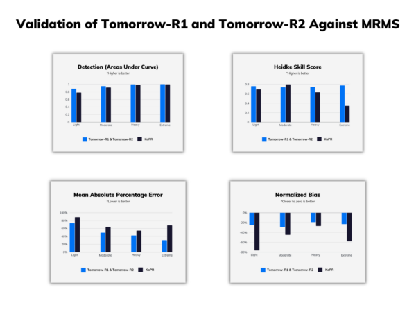
Performance metrics comparing Pathfinder to the NOAA Multi-Radar Multi-Sensor precipitation rate estimate. Statistics include Area Under Curve, Heidke Skill Score, Mean Absolute Percentage Error, and Normalized Bias indicators across rainfall intensity thresholds (light = 0.25-1 mm/hr, moderate = 1-4 mm/hr, heavy = 4-16 mm/hr, extreme = 16+ mm/hr)
We also performed the same analysis with data from the Ka-band only (KaPR) GPM product. Remarkably, we found that the Pathfinder products have similar or better performance than GPM KaPR in every statistical category – an incredible achievement considering the Multi-Radar Multi-Sensor (MRMS) references provide wholly independent observational benchmarks not utilized in any algorithm training.
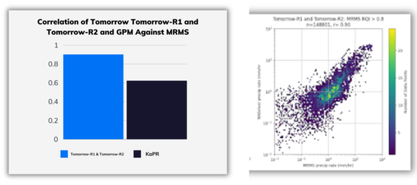
Correlation between Tomorrow-R1 and Tomorrow-R2 and reference dataset precipitation rate estimates.
The better detection capability, in particular, can be traced to the improved sensitivity of the Pathfinders relative to KaPR (the Pathfinders can detect echoes as much as 10 times weaker than the limit of KaPR). Meanwhile, improved bias and root-mean-square error can be attributed to the ML algorithm’s capability to relate the observed reflectivity structure to the microphysical details of the precipitation.
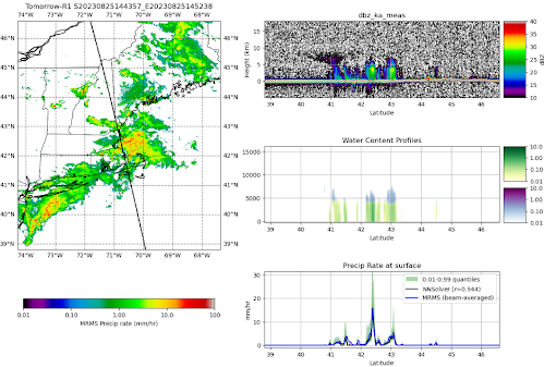
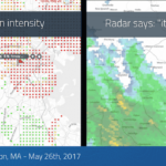
Tomorrow-R1 L2 precipitation rate estimate for a summertime thunderstorm event over New England showing precision matching ground radar estimates.
Ushering In a New Era of Global, State-of-the-Art Weather Intelligence
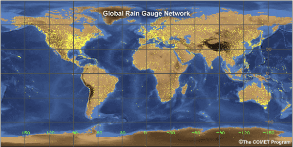
As we expand our satellite constellations in the coming years, this unique architecture will empower global hyper-localized weather analytics, matching state-of-the-art capabilities provided by ground radar networks like MRMS in the US and Europe for our customers worldwide. This data won’t just be useful for real-time precipitation observations – as the Tomorrow.io constellation grows, this high-quality dataset will grow as well and become a critical training feed for the next generation of high-resolution AI forecast models. These models are currently trained on coarse resolution (at best, 25 km) reanalysis datasets, which aren’t direct observations of precipitation but a collection of short-term forecasts. By improving the resolution and quality of the precipitation data, the promise of global, high-resolution, rapidly updating, data-driven forecasts can become reality.
Interested in knowing more? Learn about our space mission or reach out to talk to an expert.

