
TL;DR:
- Microwave sounders provide detailed data inside hurricanes, unlike traditional sensors.
- Tomorrow.io’s shoebox-sized satellites offer high-quality data at a lower cost compared to larger government satellites.
- Their satellites provide hourly refresh rates, improving storm monitoring and forecasting.
- Microwave imagery reveals vital storm features hidden beneath cloud cover.
- Tomorrow.io’s technology is filling the gap left by aging systems, offering faster and more detailed weather data for improved resilience.
Featuring Dr. Joe Munchak and Dr. Randy Chase, this expert deep dive explores how next-gen satellite technology is filling critical gaps left by aging systems, just in time for peak hurricane season.
Opening Paragraph
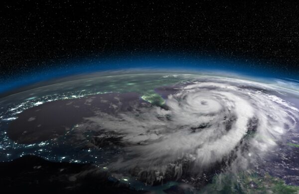
When most of us think of satellite imagery, we imagine the swirling clouds of hurricanes featured on TV or weather apps. Those visuals come from visible and infrared sensors that only capture the storm’s surface. But a different, and far more revealing, form of imaging is increasingly taking the spotlight: microwave sounders. In this Expert Forecast, Tomorrow.io’s atmospheric data scientists Dr. Joe Munchak and Dr. Randy Chase walk us through how their shoebox-sized satellites are reshaping hurricane monitoring, especially as legacy systems like DMSP reach the end of their lifespans.
1. What Are Microwave Sounders and Why They Matter
Rather than imaging only the cloud tops, microwave sounders penetrate deeper, revealing what’s happening inside storms. This includes rainfall patterns, humidity levels, and structural changes.
Dr. Randy Chase explains: “Traditional imagery captures the visible spectrum, but microwaves can pick up how raindrops and ice scatter or emit energy. This gives insight into storm intensity and dynamics that we simply can’t get from visible images.”
Microwave frequencies like 183 GHz help detect water vapor and ice characteristics, revealing vital storm features concealed beneath cloud cover.
2. School Bus vs. Shoebox: A New Satellite Paradigm
Microwave sensors historically flew on large, expensive government satellites, such as those in the Defense Meteorological Satellite Program (DMSP). These platforms offered critical data for decades but are now aging and nearing shutdown.
Dr. Joe Munchak shares: “We’re flying something the size of three or four stacked laptops. Despite the small size, the data matches what’s been achievable only with much larger satellites, but at a fraction of the cost and weight.”
Lower launch costs, ride-share opportunities, and miniaturized hardware have enabled Tomorrow.io to deploy a constellation of small microwave sounders that stand on the shoulders of NASA’s TROPICS mission design.
3. The Power of Refresh Rate: Seeing Storms in Motion
One of the biggest limitations of traditional sensing has been the temporal gap between observations, often 3 to 10 hours. That’s problematic for storms that can rapidly intensify or decay.
“Observing hurricanes only every few hours doesn’t provide enough data to predict sudden changes,” Chase notes. “Our system aims to reduce that to hourly, or even better, coverage.”
Case in point: Tomorrow.io captured Hurricane Iona during a critical intensification phase, filling a 10-hour observational void that existing satellites left open. The data quality matched or even surpassed legacy instruments, demonstrating that smallsat systems can indeed deliver high-performance monitoring.
4. What the Data Looks Like and Why It’s Compelling
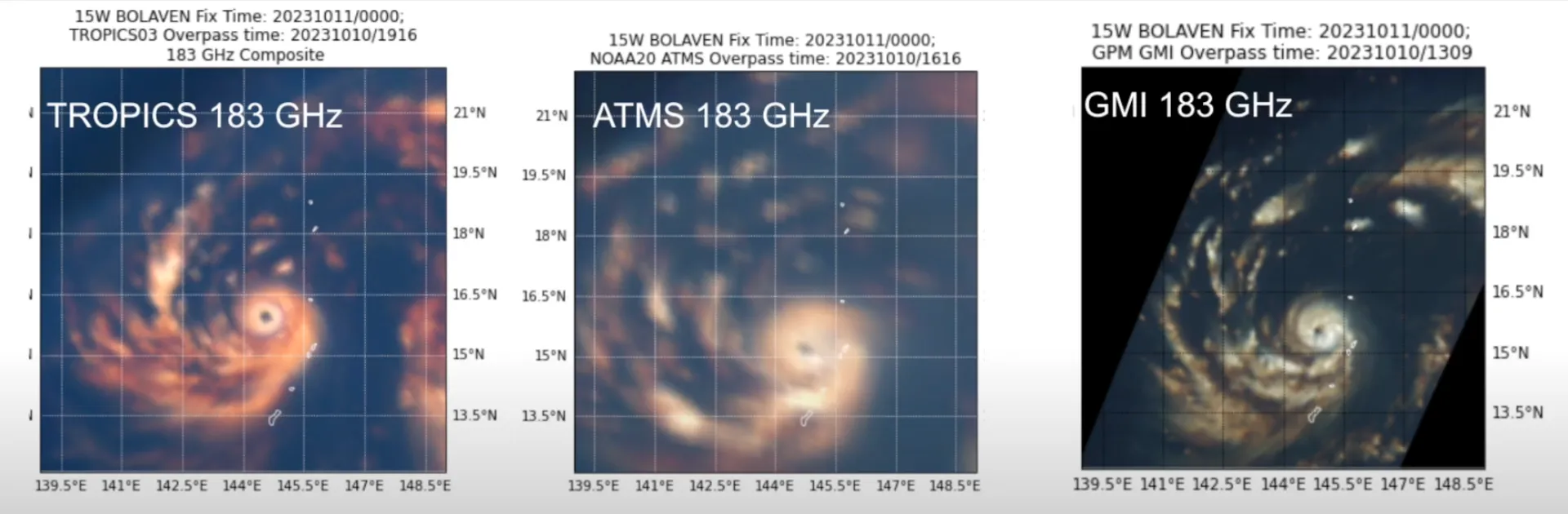
Example 1: Hurricane Iona Captured by TMS, ATMS, and GMI
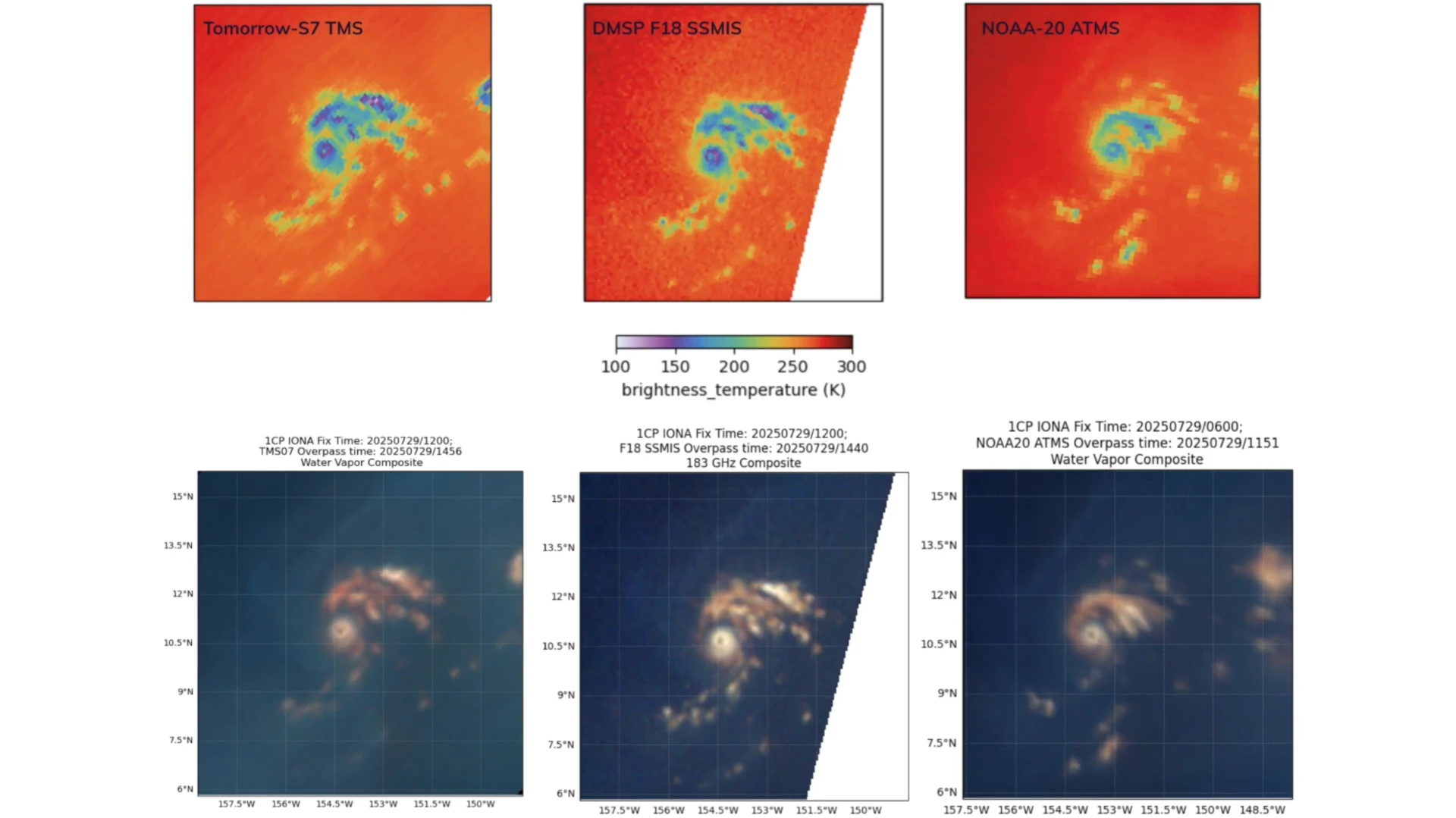
Example 1: Hurricane Iona Captured by SSMIS
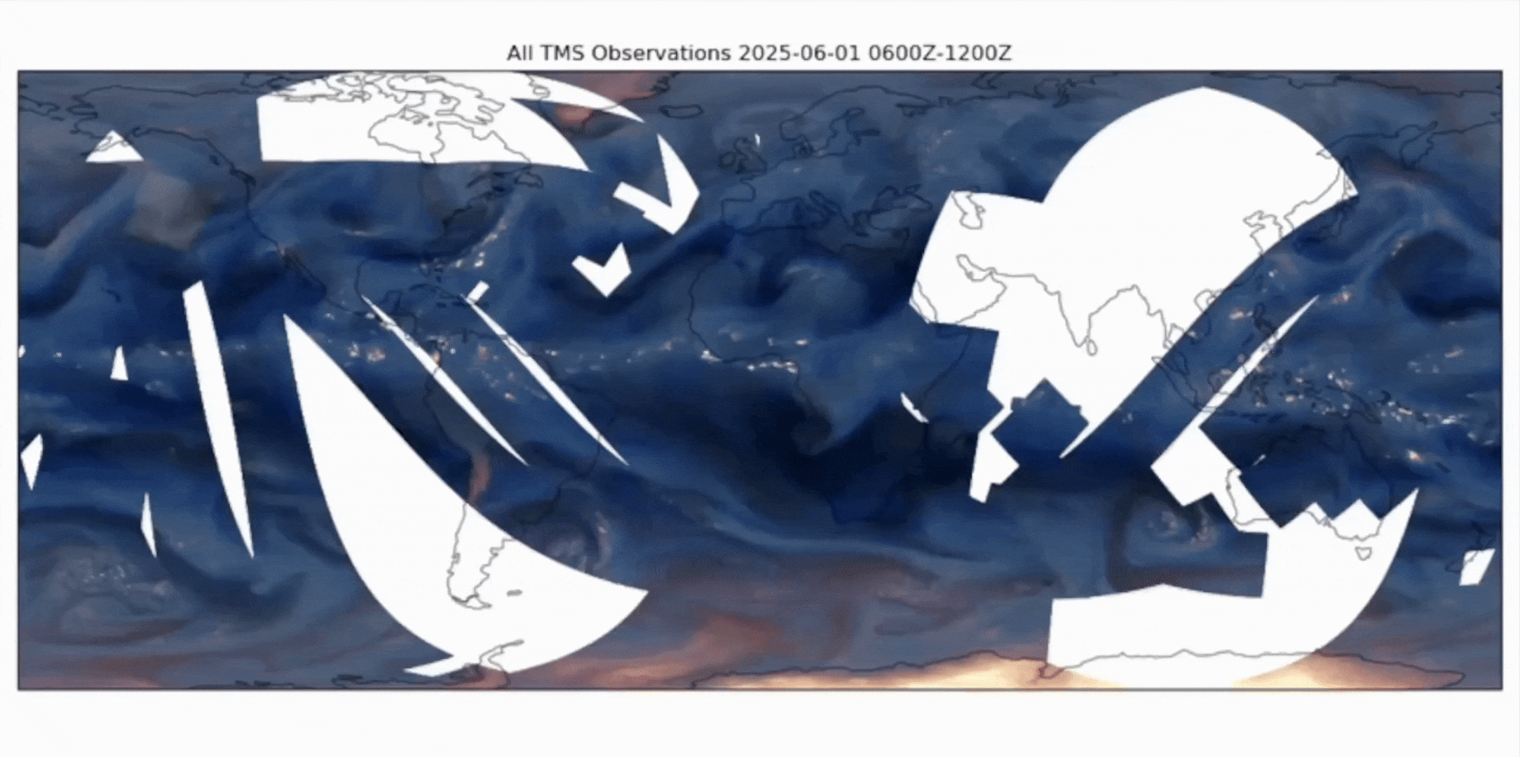
Example 2: Global Water Animation
- Example 1: Side-by-side view of Hurricane Iona captured by TMS, ATMS, and SSMIS instruments
- Example 2: Global water vapor animation, showing real-time atmospheric motion captured by TMS constellation
These visuals illustrate the clarity and depth brought by microwave imagery and the impact of capturing atmospheric data at unprecedented refresh rates.
“Refresh rate trumps resolution when you’re trying to forecast storm intensity,” said Munchak. “Even if you have a high-resolution image, if it’s 10 hours old, it’s of limited use.”
5. Building Weather Resilience One Small Satellite at a Time
Today’s climate demands faster, more detailed weather data. Tomorrow.io’s microwave sounder constellation isn’t just innovation. It’s a timely solution to a growing need.
Since February, the company has shared its data with NOAA and other partners, with 24-hour delayed access for public users. Plans for future enhancements and additional satellites promise even richer datasets and broadened global impact.
Conclusion
As DMSP and other legacy systems wane, Tomorrow.io’s microwave sounders are stepping into the breach. They offer more frequent, detailed, and responsive observation of storms. With expert guidance and emerging space technologies, we are entering a new age of weather forecasting. One where shoebox satellites help protect communities by giving us a clearer picture of the storms above.
FAQ
What are microwave sounders in weather satellites?
Microwave sounders are instruments that penetrate cloud cover to measure rainfall, humidity, and storm structure inside hurricanes. Unlike visible or infrared sensors, they provide critical data about a storm’s intensity and dynamics.
Why are Tomorrow.io’s satellites called “shoebox-sized”?
Traditional microwave sounders flew on large, bus-sized government satellites. Tomorrow.io has miniaturized this technology into satellites about the size of stacked laptops, delivering the same quality data at lower cost.
Why does refresh rate matter for hurricane forecasting?
Legacy satellites often provide updates every 3–10 hours, leaving gaps when hurricanes intensify quickly. Tomorrow.io’s constellation offers hourly—or faster—refresh rates, giving forecasters near real-time insights.
Can small satellites match the performance of larger government systems?
Yes. Tomorrow.io’s satellites have matched or exceeded the performance of legacy instruments like ATMS and SSMIS, proving that small satellites can deliver reliable hurricane monitoring.
What does microwave sounder data look like?
It appears as detailed maps of rainfall, water vapor, and storm structure beneath cloud cover. This provides more useful forecasting data than surface-only imagery.
How do microwave sounders help with climate resilience?
They provide faster, more accurate hurricane data, enabling communities, industries, and governments to prepare sooner, reduce risk, and improve disaster readiness.
Who can access Tomorrow.io’s microwave sounder data?
Tomorrow.io shares its satellite data with NOAA and other partners, while the public can access the data with a 24-hour delay. Future satellites will expand global coverage and accessibility.