
Cesar Beneti, Solutions Engineer, on data access, onboarding, technical integration, and operational deployment
As satellite weather data becomes increasingly important for forecasting and early warning systems, agencies face a critical challenge: how to move from simply accessing observations to operationalizing them inside real forecasting workflows.
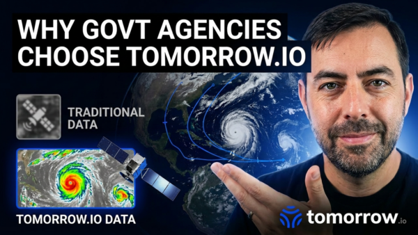
In a recent webinar on Tomorrow.io’s Microwave Sounder Constellation, Solutions Engineer Cesar Benetti walked through how researchers, government agencies, and operational forecasting teams can access, evaluate, and integrate Tomorrow.io satellite data into their systems.
His presentation focused on the practical side of adoption — from sample data downloads and research access to onboarding, technical integration, and operational deployment.
Accessing Tomorrow.io Satellite Data
Cesar began by explaining that Tomorrow.io provides several pathways for accessing satellite data, depending on the user’s needs.
For individual users, the company offers sample Level 1 and Level 2 datasets directly through its website. These datasets allow users to explore the structure, format, and content of the constellation’s products before moving into deeper evaluations.
For research applications, users can also request archived data for specific geographic regions and time periods. Requests are reviewed on a case-by-case basis, after which researchers receive guidance on how to access the approved datasets.
The goal is to make it easier for scientists and technical users to begin evaluating the operational potential of the data.
How Government Agency Engagement Works
For government agencies, the process becomes more structured and collaborative.
According to Cesar, engagements typically begin with discovery meetings and scientific briefings involving Tomorrow.io’s science and engineering teams. These discussions help define:
- Operational use cases
- Product requirements
- Geographic coverage
- Data formats
- Integration goals
Once the agency decides to proceed with a trial, the teams establish an NDA or MOU and begin defining the specific datasets required for evaluation.
Agencies may request:
- Level 1 or Level 2 products
- Regional or global coverage
- NetCDF or other WMO-compatible formats
From there, Tomorrow.io begins the trial delivery phase, providing technical onboarding, documentation, and operational support throughout the process.
Flexible Delivery and Integration Support
Cesar emphasized that operational usability is a major priority.
Satellite data can be delivered through:
- API endpoints
- Cloud storage buckets such as Amazon S3
- Other operational delivery pipelines
This allows agencies to ingest observations directly into their existing forecasting and data assimilation systems.
During integration and evaluation, agencies can begin testing the impact of the data inside their numerical weather prediction workflows, including:
- Data assimilation pipelines
- Forecast validation systems
- Accuracy and performance evaluations
- Operational nowcasting workflows
Tomorrow.io also provides technical support for agency scientists and operational teams throughout the process.
From Evaluation to Operational Forecasting
Once evaluations are complete, agencies can move toward operational deployment.
At this stage, service-level agreements define:
- Data availability
- Delivery reliability
- Operational support
- System accountability
By this point, agencies typically have automated real-time ingestion pipelines in place, enabling satellite observations to flow continuously into operational forecasting systems.
This allows the data to support:
- Weather forecasting
- Nowcasting
- Early warning systems
- Operational meteorology workflows
Cesar explained that the ultimate goal is to help agencies move from testing the data to fully operational use inside production environments.
Supporting Technical Onboarding and Data Assimilation
A major part of the onboarding process involves technical enablement.
Tomorrow.io helps agencies define:
- Areas of interest
- Product selection
- Delivery methods
- Data formats
- Assimilation configurations
The company also supports integration into systems such as JEDI (Joint Effort for Data Assimilation Integration), the data assimilation framework developed through the Joint Center for Satellite Data Assimilation (JCSDA).
Calibration reports, technical documentation, and enablement support are also available throughout onboarding and integration.
According to Cesar, the goal is not simply to deliver data, but to help agencies operationalize it successfully.
Making Satellite Data Easier to Explore
Toward the end of the session, Cesar demonstrated Tomorrow.io’s online Data Catalog.
Through the platform, users can:
- Browse available Level 1 and Level 2 products
- Download sample datasets
- Request archived observations
- Define geographic regions and time ranges
- Select specific sensors such as microwave sounders
Researchers can also customize requests by selecting:
- Spatial domains
- Time periods
- Product types
- Global or regional coverage
Once submitted, requests are reviewed for analysis and approval.
Turning Satellite Observations Into Operational Capability
Cesar’s presentation highlighted an important reality for modern forecasting organizations: operational value comes not just from satellite observations themselves, but from how effectively those observations can be integrated into forecasting systems.
By combining flexible data access, onboarding support, technical integration, and operational delivery pipelines, Tomorrow.io is working to help agencies move more quickly from evaluation to real-world operational forecasting.
As weather forecasting systems continue evolving toward higher-frequency, data-driven prediction models, that operational integration layer may become just as important as the observations themselves.
Reach out to [email protected] to learn more.