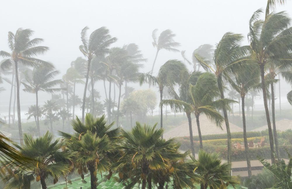
Hurricanes are some of the most destructive forces of nature, capable of causing immense damage to communities in their path.
As climate change leads to more rapid intensification of storms, the world needs better forecasting technology to predict hurricanes and give people time to prepare.
In late October, Hurricane Otis hit Acapulco on the west side of Mexico. Otis was a rapidly intensifying storm, evolving from a tropical storm to a Category 5 hurricane in a record 12 hours.
Recently, we sat down with a trio of experts from Tomorrow.io, including Principal Atmospheric Scientist Joe Munchak, Technical Fellow, Jim Carswell, and VP of Product Cole Swain, to learn more about these rapidly intensifying storms and discuss advancements in space technology that will improve the ability to detect them sooner.
You can catch highlights of the interview below or watch the conversation.
Why Are Hurricanes So Hard to Predict?
Hurricanes pack incredibly fierce winds and torrential rainfall, causing immense damage to anything in their path.
Unlike other large weather systems, hurricanes can undergo “rapid intensification,” exploding in strength in under 24 hours. This unpredictability makes it incredibly challenging to forecast accurately.
Over the past few decades, meteorologists have greatly improved hurricane track forecasting, predicting the path a storm will take. However, forecasting changes in intensity continue to lag behind.
Without enough real-time data on conditions inside hurricanes, the ability to alert local communities is difficult.
As Joe Munchak, Principal Senior Atmospheric Scientist at Tomorrow.io, explains:
“What makes hurricanes unique is their small scale relative to really big weather systems…and how they can change in intensity very rapidly. The intensity forecasting has lagged behind, although some improvements have been made, we understand it better, but it’s still a matter of getting good enough observations to make those forecasts.”
He even explains a little about the current state of hurricane forecasting:
“So, right now for hurricane monitoring, we have geostationary satellites. These are the workhorses, um, that have been put up by NOAA and the European Meteorological Satellite Agency and Japanese Meteorological Agency. These satellites take pictures of the earth every 10 or 15 minutes, but these satellites really only see the cloud top, and that can tell us where a hurricane is.
So we need these other tools like these microwave sounders and the radar.”
Why We Need Satellites to See Inside Hurricanes
The biggest barrier to accurate hurricane forecasting is the lack of real-time data and visibility into the inner structure of storms far out at sea.
As Cole Swain, VP of Product at Tomorrow.io describes:
“The observations are critical to really improve the models. But also the observations are used by the hurricane specialists, the forecasters in real time. And they’re looking at all these different models…And what the observations do is it allows them to evaluate what models are doing best in real-time.”
Aircraft only fly into and take measurements of hurricanes approaching the U.S. coast. Everywhere else, forecasters rely on sporadic satellite passes that miss short-term changes.
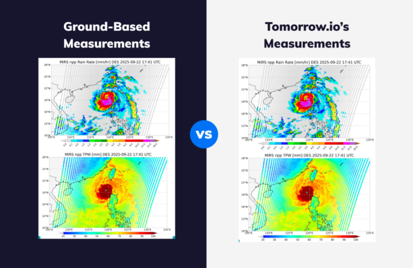
Tomorrow.io’s constellation of radar and microwave-sounding satellites will provide unmatched real-time 3D views of hurricane structure, rainfall, and intensity anywhere on Earth. Instead of one overpass every few days, Tomorrow.io’s satellites will scan storms hourly, capturing rapid intensification as it happens.
As Joe Munchak describes:
“Our satellites are unique in a couple of ways. They’re really coming in with two different types of instruments. One is a weather radar, and weather radar is a really great tool for understanding hurricanes because it scans the storm in three dimensions.
Now, the other type of satellite we’re going to have is called a microwave sounder. And that type of satellite measures emissions from the earth in the microwave spectrum, which is the same spectrum that weather radars operate at, except instead of sending out a signal, it’s just listening to the natural signals emitted from the earth.
Giving Forecasters the Data They Need
Tomorrow.io’s space-based weather data will arm forecasters with the accurate real-time weather intelligence they need to issue earlier warnings and save lives.
Jim Carswell, Chief Architect at Tomorrow.io, explains how new satellite data can improve forecast model accuracy and forecaster confidence:
“The more observations we get, as the models are developing and improving, the forecast is gonna have the tools that they need to make the best warning or forecast in the short term that they need.”
Jim also describes how more frequent 3D scans of storms will aid forecasters:
“It’s gonna give that three-dimensional view over the whole area. On an hourly basis. That’s huge. And it can be utilized to help better use the aircraft so they don’t have to fly over the whole area. We can deploy those or other resources, in areas where we can get additional information.”
What Is a Rapidly Intensifying Storm?
One of the most dangerous qualities of hurricanes is their ability to undergo extremely rapid intensification. When storms explode in strength right before landfall, communities are caught off guard.
According to Joe, a rapidly intensifying storm, if you look back at the academic papers that define this, is a storm with an increase in wind speed of 30 knots over 24 hours.
In late October 2023, Hurricane Otis intensified by nearly 90 mph in just 12 hours before hitting Mexico. With limitations in today’s forecasting abilities, Tomorrow.io’s hourly radar scans would have captured 13 more observational updates during the 8-hour intensification.
As Joe Munchak explains:
“With the Tomorrow.io constellation, we’ll have much, much more frequent revisit with less than an hour gaps between data coming from our satellite constellation.”
Cole Swain adds on saying, “From the analysis that we did a few days after, it looked like we would have had thirteen additional scans during the first eight-hour period of escalation.”
By monitoring inside hurricanes in real time, Tomorrow.io will be able to detect rapidly strengthening storms and help give communities critical extra hours to respond.
Saving Lives Through Earlier Warnings
The ultimate goal of improving hurricane forecasting is protecting human life. With earlier warnings from satellite data, emergency managers can call for evacuations sooner and save lives.
When it came to Hurricane Otis, no one had a warning. People went to bed assuming there would be a storm with some heavy rain, but not the devastation that was caused.
Cole talks about how added forecast accuracy translates into life-saving preparedness:
“Even an hour earlier of notice, even six hours earlier of notice before you go to bed so that you can make sure that you’re taking care of the people that you’re dependent on or reverse I mean, just giving that advanced notice for preparation of people, it’s invaluable.”
As Joe also notes:
“Six hours of extra notice, twelve hours of extra notice could make a huge difference in terms of protecting life and property in a situation like this.”
Preparing Communities Around the World
Tomorrow.io’s future globally comprehensive space-backed weather data will help forecasters track developing storms anywhere on Earth. This will provide life-saving early warning capabilities to vulnerable regions without existing hurricane monitoring.
Additionally, by better understanding global hurricane behavior, Tomorrow.io’s data will help communities assess risk, plan adaptations, and build resiliency in our changing climate.
As Jim Carswell explains:
“The observations that we’re able to provide from space will give forecasters the confidence to narrow hurricane warnings and reduce false alarms… By improving global hurricane observations each hour, we can better predict threats, trace storm lifecycles, and help communities spend limited resources more wisely to build resilience where it’s needed most.”
With Tomorrow.io’s constellation of satellites, they will be able to arm communities worldwide with the intelligence needed to prepare for and adapt to intensifying storms.
Conclusion
Tomorrow.io’s revolutionary satellite constellation will represent a new era in hurricane monitoring and forecasting. By seeing inside storms in real time, we can detect rapid intensification, provide earlier warnings, and give communities time to respond.
Accurate forecasting saves lives, and Tomorrow.io’s weather data platform is expanding global resilience in the face of more extreme storms ahead.


