How Frequent Microwave/Radar Scans Could Have Foreseen Hurricane Otis’ Rapid Strengthening
What Happened With Hurricane Otis?
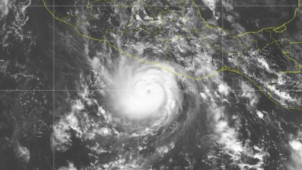
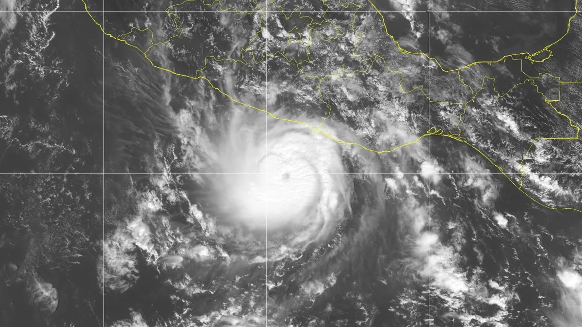
Via NOAA, Hurricane Otis at 5 p.m. on Oct. 24, 2023.
Hurricane Otis unexpectedly intensified from tropical storm (70mph) to Category 5 (160mph) in only 12 hours on October 24, 2023, catching the coastal city of Acapulco off guard.
The Limitations of Current Observations
Infrequent microwave imager passes (only 3 in 12 hours) combined with a lucky partial radar overpass and 6 microwave sounder passes limited insights into the storm’s core structure and thus key signs of the rapid intensification were missed. Multiple data gaps of 2-3+ hours during the rapid intensification phase limited forecasters’ ability to observe this process in real time.
How Tomorrow.io Could Have Helped Forecast Hurricane Otis
Hurricane Otis could have been supported with additional scans to foresee its rapid intensification.
Backed by Tomorrow.io’s future rapid-refresh satellite constellation, our frequent radar / microwave scans, capable of penetrating cloud cover, profiling storm structure, measuring precipitation symmetry, temperature, condensation, and derived wind speeds, would have delivered over 13 more scans during its most critical intensification phase and 26 total observations through the 12 hour period.
Observed eye temperature and eyewall storm top heights could have detected patterns indicative of rapid strengthening, potentially providing 6 to 12 hours of additional preparation time.
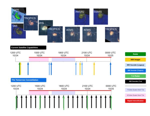
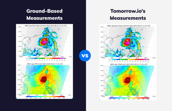
Figure 1: Timeline of satellite radar and passive microwave observations of Hurricane Otis’s rapid intensification from 65 to 145 mph, 24-25 October 2023 (1200 UTC 24th to 0000 UTC 25th), based on preliminary NHC estimates. In contrast, below, a timeline of scans the Tomorrow Constellation will contribute once fully operational
How Tomorrow.io Is Addressing Critical Data Gaps
During Hurricane Otis’s rapid intensification, several passive microwave sensors and the GPM DPR radar observed the hurricane.
The NASA/JAXA GPM core observatory fortunately passed over the storm just as it was intensifying, partially capturing the detailed precipitation structure within the 250km radar swath (this close of an overpass typically only happens once every two days for an individual storm).
Although three operational microwave sounders and data from NASA’s TROPICS mission offered some insights, multi-hour data gaps remained.
The Tomorrow.io constellation, with its high-resolution, wide-swath radar, aims to revisit every 4-6 hours, similar to current microwave imagers, and every hour or less with microwave sounders.
This, along with TROPICS and existing sounders, will reduce worst-case data gaps to under one hour, ensuring no rapid intensification events are missed.
Interested in learning more about how Tomorrow.io is supporting hurricane forecasting?
We sat down with Atmospheric Scientist, Joe Munchak, VP of Product, Cole Swain, and Technical Fellow, Jim Carswell to learn about how space-backed weather intelligence will revolutionize hurricane forecasting.
Catch the interview below.
