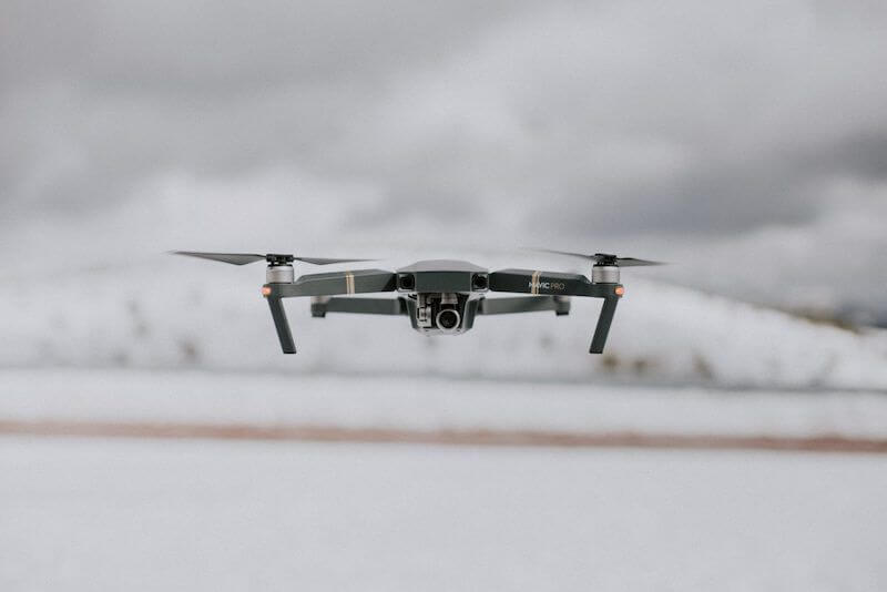
Drone technology seems limitless, but traditional weather forecasting means the sky is the limit for drones. Companies like Mercedes-Benz, Amazon, and UPS are developing drone delivery technologies, while in the consumer sector, drones are used for everything from fishing to umbrella-holding and, of course, aerial photography. Drones might one day provide temporary internet coverage in war zones or even carry people as passengers. As technologies take flight and go mainstream, the success of this industry hinges on staying ahead of the weather or at least, navigating around rapidly shifting adverse weather in real-time.
The widespread use of drone delivery is good news for the environment – reducing land-based vehicle emissions. However, unlike ground fleets that may be able to continue operations in windy or stormy conditions, drones are highly sensitive to the elements. This means UAVs need smarter geofencing powered by finely-tuned weather forecasting to maintain operations when clouds form on the horizon – and precipitation hits the ground.
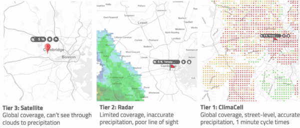
Low-lying weather poses a high risk to UAVs operating at low altitudes, but traditional technology faces some disadvantages when forecasting at under 1000 feet, where drones fly the most. The good news is that this coverage gap can be erased by blending emerging weather forecasting technologies with the traditional tools. These advancements tackle the challenges faced by unmanned aerial systems and make it possible to get minute-to-minute, ground-level, MicroWeather forecasts.