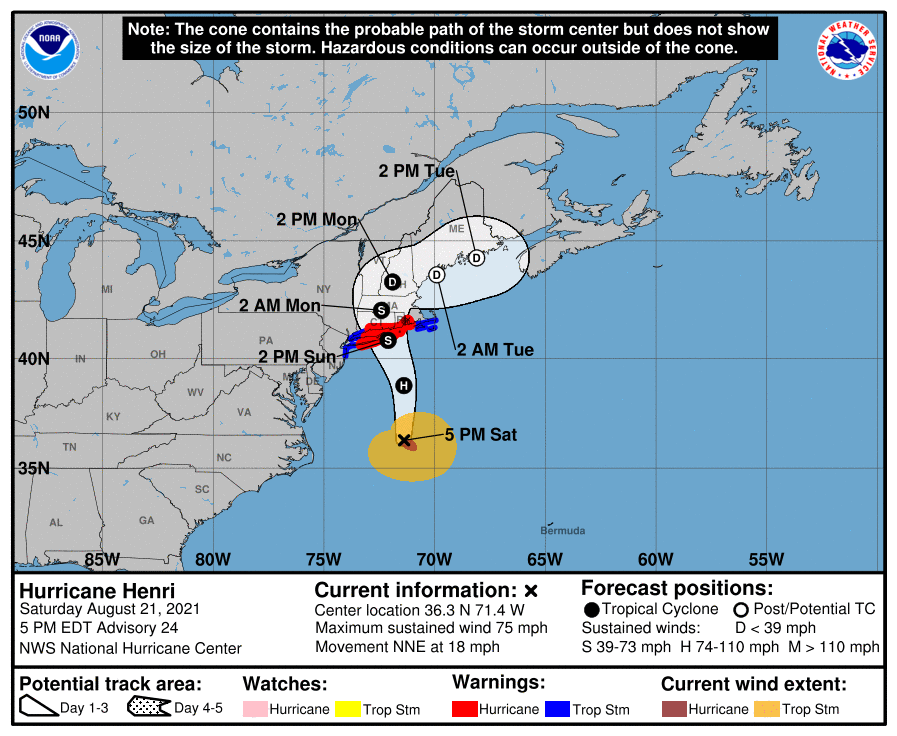
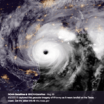
Henri has strengthened into a Category 1 Hurricane, and Hurricane Henri has maximum sustained winds of 75 mph, currently located 335 miles south of Montauk Point, New York, moving north-northeast at 18 mph. Hurricane Henri is expected to track generally northward towards Long Island and make landfall between central/eastern Long Island to Rhode Island Sunday evening as a hurricane or a strong tropical storm. Henri is expected to quickly weaken early Monday morning as it tracks north-northwestward into central MA and upper New England later on Monday as a tropical depression, dissipating Monday evening. Periods of heavy rainfall are expected across southern New England Sunday into Monday.
Detailed overview: Boston, MA
- Sunday 8AM – 5PM: From 8am-12pm on Sunday, the initial outer rain bands from Hurricane Henri arrive. This will bring periods of rain, moderate to heavy at times, on Sunday from 8am through 5pm. Winds on Sunday pick up to 10-15 kt gusting to 20 kt after 6am, increasing to 15-25 kt after 1pm gusting to 35 kt.
- Sunday evening: As the track of Henri shifts more towards the north-northwest later on Sunday, the heavier shower activity will push off to the west of BOS. From 5pm-8pm, periods of moderate to heavy rain remain possible but less frequent, with occasional rain showers possible after 8pm through the remainder of the evening, with drier trends overnight. Winds increase to 18-27 kt gusting to 40 kt after 4pm.
- Monday: As Henri continues northward on Monday and quickly weakens to a tropical depression over New England, scattered showers and thunderstorms will be possible at BOS in the late morning through the afternoon and evening on Monday, as then the remnants of Henry lift off to the northeast. Winds decrease after 1am Mon to 10-20 kt gusts to 25-30 kt. Winds decrease to 8-15 kt after gusts to 20 kt after 1pm Mon.
For those who want to be extra cautious – prepare yourself for a short power outage and make sure your outdoor equipment is secured, but that’s always a true statement ahead of stormy weather.
